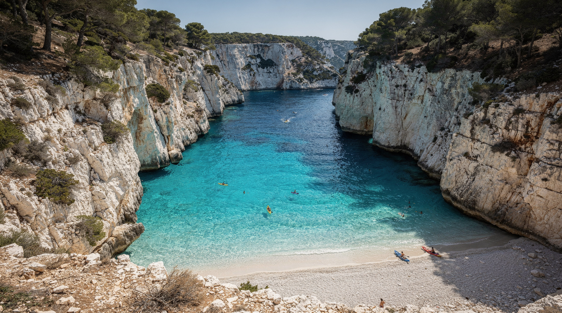
Hiking the Calanques from Luminy: the gateway explained
Marseille: Calanques National Park guided hike
Duration: 5 hours
How do I get to Luminy to hike the Calanques?
Bus 21J or B1 from Castellane métro (lines 1 and 2), alight at 'Luminy PN des Calanques' — the last stop. About 30 minutes from Castellane. Free car park on site but fills by 9:00 on warm weekends. Bus is the better option.
Why Luminy is the key southern Marseille gateway
Of all the access points to the Calanques National Park from Marseille, Luminy is the most used and the most important. It provides the shortest on-foot approach to Sugiton — the closest major calanque to the city — and serves as the starting point for trails reaching Morgiou, the Sormiou ridge, and the interior massif connecting to the GR98 toward Cassis.
The practical reason Luminy matters is that it is the only major Calanques trailhead on the Marseille side that is directly accessible by public bus without a car. For visitors staying in central Marseille without a rental car, Luminy is the gateway to the southern calanques.
Understanding how to get there, what the parking situation actually is, and what is reachable from this point makes the difference between an efficient visit and a frustrated morning.
| At a glance | |
|---|---|
| Where | Domaine de Luminy, 9th arrondissement, southern Marseille |
| Cost | Free bus stop access; free car park (fills early); Sugiton reservation free on regulated dates |
| Time needed | Around 3 hours round trip for Sugiton; 4-5 hours for Sormiou-Morgiou loop |
| Getting there | Bus 21J/B1 from Castellane métro (~30-35 min); no rail option |
| Best time | April-June and September-October; avoid July-August unless checking access status daily |
Getting to Luminy by public transport
From Castellane métro station (lines 1 and 2):
Bus 21J (also signed 21JET) or B1 from Castellane to the “Luminy PN des Calanques” stop. This is the last stop on these routes — there is no risk of overshooting.
Journey time: approximately 30–35 minutes from Castellane, depending on traffic on the Boulevard Michelet.
Frequency: approximately every 15–20 minutes during peak daytime hours on weekdays. Reduced frequency on weekends and early mornings. Check the RTM (Régie des Transports Métropolitains) schedule or the Moovit app for real-time departures.
Bus 24 also serves the Luminy area but its route and stop locations vary — verify the exact stop on a route planner before relying on it.
From Sainte-Marguerite/Dromel métro (line 2):
The B1 also serves this station — useful if you are coming from the southern part of the city or from the Prado area.
Full journey from central Marseille (Vieux-Port to Luminy trailhead):
- Vieux-Port to Castellane: 5 minutes on métro line 1
- Castellane to Luminy by bus: 30–35 minutes
- Total from Vieux-Port: approximately 40 minutes
Getting to Luminy by car
The Domaine de Luminy is reached via the Route de Luminy in the 9th arrondissement, running south from the Boulevard Michelet. From the city centre, allow 25–30 minutes by car in non-peak traffic.
Parking: The Luminy campus car park is free and open to the public. It is located directly adjacent to the national park boundary, near the Ecole d’Art. On a warm weekend in spring — say, a sunny Saturday in April — the car park is full by 09:00, sometimes earlier. Arriving at 10:30 means parking on the roadside significantly further from the trailhead and adding 20 minutes of walking.
The parking reality: On weekdays in shoulder seasons, the car park is manageable. On any sunny weekend from April through October, take the bus. It is genuinely faster (no parking search, no walking from a distant roadside spot) and eliminates the frustration.
What the Luminy trailhead looks like
The bus stop “Luminy PN des Calanques” is at the edge of the university campus, immediately adjacent to the national park entry point. There is a marked information board with a trail map, distances, and access rules. In summer, a park warden is sometimes present at the board to check reservations for Sugiton.
The trail begins clearly from the car park — the path into the garrigue is signed for “Sugiton,” “Morgiou,” and “Sormiou.” Within 5 minutes of leaving the car park, the university buildings disappear and the landscape becomes pure national park: limestone scrub, sky, and silence.
Facilities at Luminy: Toilets at the university campus (may be accessible during opening hours). No food or water point. No gear rental. Bring everything you need before arriving.
Luminy routes compared
| Destination | Time from Luminy | Difficulty | Best for |
|---|---|---|---|
| Sugiton | 45-55 min each way | Medium (rope-aided descent) | First-time visitors, half-day plan |
| Morgiou | 60-80 min each way | Medium, longer approach | Quieter, more enclosed calanque |
| Sormiou ridge/descent | 90+ min each way | Challenging | Experienced hikers with a full day |
| GR98 toward Cassis | Multi-day traverse | Challenging | Long-distance hikers |
What is reachable from Luminy
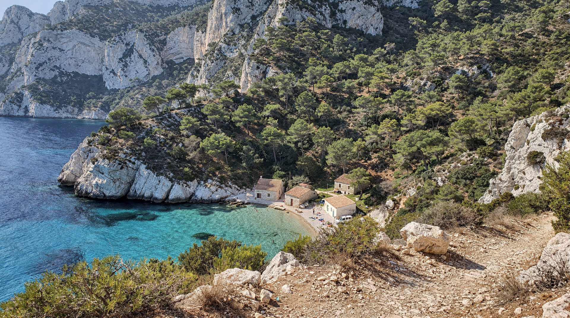
Calanque de Sugiton (45–55 min, medium difficulty)
The primary destination from Luminy. See the Sugiton hike guide for the complete route description including the rope-aided descent section, reservation requirements, and return times. The round trip from Luminy with 45–60 minutes at the calanque takes approximately 3 hours total.
Calanque de Morgiou (60–80 min, medium difficulty)
East of Sugiton along the ridge, Morgiou is quieter and more enclosed. The trail from Luminy reaches Morgiou via the Belvédère viewpoint — a longer approach than Sugiton but rewarding for the more intimate atmosphere of this smaller calanque. The Sugiton–Morgiou connecting trail (45 min) allows both calanques in a single long day.
Sormiou ridge and descent (90+ min, challenging)
The trail from Luminy can reach the Sormiou ridge and eventually descend into Sormiou, but the distance and elevation make this a more demanding undertaking than the Sugiton or Morgiou routes. The Sormiou–Morgiou loop from Luminy is a serious 4–5 hour day hike. See the Sormiou guide for detail.
GR98 connection
The GR98 long-distance trail passes through the Luminy area, allowing connection to the full traverse toward Cassis. Starting the GR98 from Luminy (rather than Callelongue) reduces the distance by approximately 5 km and cuts out the initial Marseilleveyre climb. Some walkers begin the two-day GR98 traverse from Luminy specifically for this reason. See the GR98 guide.
Timing and seasonal considerations
April–June: The optimal Luminy window. Bus access is smooth, the trails are fully open, temperatures are comfortable. Arrive at the bus stop in Castellane no later than 08:00 on weekends to reach the trailhead at a reasonable hour.
June 20 onward: Sugiton reservation becomes mandatory on weekends and eventually every day through August 30 (see exact 2026 dates in the Sugiton guide). Arrive with QR code ready; wardens check at the trail entry point.
July–August: Trail closures make the Luminy trails inaccessible on most days. The bus still runs to Luminy (it serves the university campus), but the national park trails may be behind locked barriers. Check access status at calanques-parcnational.fr after 18:00 the evening before any summer visit.
September–October: Trail access resumes. Temperatures drop to comfortable hiking levels. The car park fills less quickly. This is the best season for a relaxed Luminy-to-Sugiton morning.
Winter (November–March): Trails open, minimal crowds, cold sea, extraordinary light on the limestone. The bus runs at reduced frequency — check RTM for the current winter schedule.
What to bring
The Luminy trailhead is the last point at which you can adjust before entering the national park. From here, there are no shops, no water, no shade:
- Water: at least 1.5 litres per person for a Sugiton return in spring; 2+ litres from June onward
- Food: no resupply until you return
- Footwear: proper hiking shoes; not sandals or flat trainers
- Sunscreen and hat: the trails are exposed
- Sugiton QR code reservation (on regulated dates): shown at the trailhead checkpoint
The Luminy landscape: what you see before you descend
The walk from the Luminy car park to the Sugiton viewpoint takes about 20 minutes before any significant descent begins. This section is worth experiencing slowly — the landscape has a character that the calanque at the bottom does not.
The garrigue plateau immediately behind Luminy is the dominant ecology of the Calanques massif: low, dense Mediterranean scrub adapted to thin limestone soil, extreme summer heat, and drought. The main species are rosemary (endemic to limestone soils here), white cistus (the papery white flowers in April–May), kermes oak (a dwarf, spiny oak that barely reaches knee height), and Aleppo pine.
In April and May, the garrigue flowers sequentially — first the yellow Jerusalem sage along the path edges, then the white cistus carpet across the open sections, then the pink helianthemum (rock rose) in the more exposed sites. The smell of warm rosemary and pine resin, with the salt air below, is specifically Provençal in a way that no coastal or urban Marseille experience delivers.
What to watch for en route:
- Green lizards on the warm rocks in the morning sun (April–September)
- Blue rock thrush on the cliff faces near the Sugiton viewpoint
- Bonelli’s eagle circling the thermals above the massif on warm spring mornings — look for a large raptor with a dark back and pale underwings
- Montpellier snakes crossing the path in the April–June period (harmless, quick to disappear)
The Luminy university context
The Luminy campus is a significant university and research site — Aix-Marseille University’s science and technology campus, plus the Ecole Nationale Supérieure d’Architecture et de Paysage de Marseille (the architecture and landscape school). The research institutes on the campus include marine biology and ecology groups whose work relates directly to the Calanques National Park and marine reserve. The boundary between academic research on the massif and tourist recreation on the massif runs through the Luminy car park.
This creates an occasionally odd atmosphere at the trailhead on a weekday morning — students cycling to class past hikers adjusting their packs, laboratory workers walking to the research buildings past families loading up with water and sunscreen. The juxtaposition of university routine and national park adventure is specific to Luminy and not to any other Calanques access point.
When the trails are closed: what Luminy looks like
On a fire-risk red day, the trail entrances at Luminy are physically blocked — typically with a chain or barrier across the path, sometimes with a warden present at the car park entry. The car park itself remains accessible (the university continues operating). You can park and walk to the park boundary but cannot proceed on the trails.
This creates visible frustration on summer mornings when conditions are good by tourist standards (blue sky, hot, sunny) but the fire risk assessment says otherwise. The assessment incorporates humidity and wind that the sky doesn’t show — a low-humidity day with a building mistral is exactly when fire risk is highest, regardless of how pleasant the morning appears from the car park.
The warden presence at Luminy is more consistent than at other Calanques access points — it is the highest-volume entry point and the one where the park service concentrates its enforcement. Do not attempt to go around a barrier on a closed day.
Combining Luminy with other Marseille activities
The bus back from Luminy (21J or B1 to Castellane) takes 30–35 minutes and reconnects you to the entire Marseille metro and tram network. A morning at Luminy-to-Sugiton followed by an afternoon in the Vieux-Port area or Le Panier is entirely practical timing — finish at the calanque by 13:00, bus back to Castellane by 14:00, lunch in the city by 14:30.
For those combining the Calanques with other Marseille activities, see how many days in Marseille and the Marseille guide for afternoon options in the city. For the do-you-need-a-car question that is directly relevant to Luminy access, see do you need a car in Provence.
For the full Calanques context, see the Calanques National Park guide. For the Sugiton-specific guide, see the Sugiton guide. For the Sormiou and Morgiou approach, see the Sormiou guide. For a comparison of all access points and difficulty levels, see Calanques hikes by difficulty. For those planning a summer visit and wondering about boat alternatives, see the boat tour guide and Marseille in summer.
Luminy versus other Calanques gateways
Luminy is not the only way into the massif, but it is the only major trailhead reachable without a car. Callelongue (further west, past Les Goudes) requires a car or a longer bus-plus-walk combination and reaches Sormiou and Marseilleveyre from the opposite direction. Cassis, on the eastern side, gives boat and kayak access to En-Vau and Port-Pin without any hiking at all — see the Cassis vs Marseille calanques boat comparison if you are undecided between the two sides.
For visitors without a car staying in central Marseille, Luminy remains the simplest starting point, especially when paired with the safety guidance in our Calanques hiking safety guide and the seasonal access rules in our summer access rules guide.
Frequently asked questions about hiking from Luminy
Can I reach the Calanques from Luminy without hiking experience?
The walk to Sugiton is manageable for a reasonably fit adult with proper footwear, but it includes a rope-aided rocky descent near the end that is not suitable for young children or anyone uncomfortable on uneven terrain. See the kid-friendly Calanques guide for family-appropriate alternatives.
Is there a shorter walk from Luminy for people short on time?
Not really — Sugiton at 45-55 minutes each way is already the shortest option from this trailhead. If you want something faster, a boat tour from the Vieux-Port (see the boat tour guide) reaches multiple calanques in less total time than the Luminy-to-Sugiton hike alone.
Top experiences
Bookable activities with verified prices and instant confirmation on GetYourGuide.