Verdon Gorge
Verdon Gorge guide — the Grand Canyon of Europe, Sainte-Croix lake, kayaking, Sentier Blanc-Martel hike, and honest day-trip distances from Marseille.
Aix-en-Provence: Verdon Canyon & Moustiers-Sainte-Marie
Duration: 8.5 hours
Quick facts
- Distance from Marseille
- ~2 h by car; from Aix-en-Provence ~1 h 30
- Canyon depth
- 250–700 m; 25 km long
- Sentier Blanc-Martel
- 15 km, 5–7 h; shuttle required (book 24 h ahead)
- Sainte-Croix lake
- Largest artificial lake in Provence; swimming and kayak rental
- Honest verdict
- 2 h from Marseille — tight as a day trip. Better with overnight in Moustiers.
Europe’s Grand Canyon
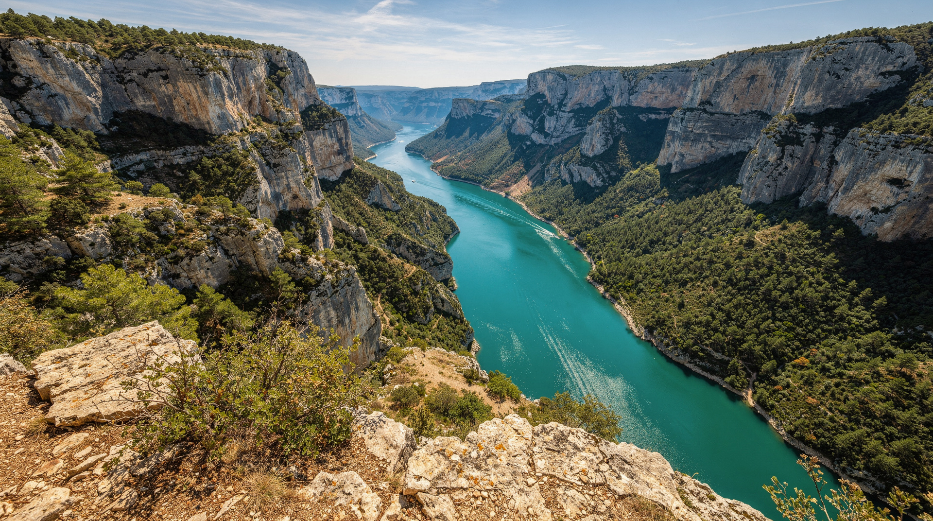
The Gorges du Verdon is 25 kilometres of canyon cut by the Verdon River through the limestone plateau of the Alpes-de-Haute-Provence. The walls drop between 250 and 700 metres from the plateau rim to the river, making it the deepest canyon in Europe — hence the comparison with the Grand Canyon of the American Southwest, which it genuinely resembles in structure if not in scale.
The turquoise colour of the Verdon River is not a photographic effect or a seasonal phenomenon. The water carries dissolved minerals from the limestone and chalk upstream, and in summer the river runs a consistent blue-green that looks artificially intense against the grey and white canyon walls. It is real.
The gorge and its surrounding territory make up the Verdon Regional Nature Park, one of the largest regional parks in France. The park limits development inside the gorge itself; the roads and villages on the plateau rim are where visitors base themselves.
| At a glance | |
|---|---|
| Where | Alpes-de-Haute-Provence, roughly 2 h from Marseille, 1 h 30 from Aix-en-Provence |
| Cost | Free to view from the rim roads and belvedères; kayak rental around EUR 12–20/hour; Sentier Blanc-Martel shuttle a small fixed fee |
| Time needed | A full day minimum; 2–3 days to combine the hike, the lake, and Moustiers properly |
| Getting there | Car is effectively required — no useful public transport into the gorge itself; organised day tours run from Aix and Marseille |
| Best time | April–June and September–October for hiking and driving; late June–early September for lake swimming |
Honest distance assessment
From Marseille to the Verdon Gorge is approximately 2 hours by car. From Aix-en-Provence, approximately 1 hour 30. This is relevant because it determines what kind of day trip is realistic.
From Marseille: 2 hours each way means 4 hours of driving for a day that should include at least 3–4 hours of activity. This is tight. You can do it — leave Marseille at 07:30, arrive at the lac de Sainte-Croix by 09:30, kayak or do the Route des Crêtes drive, lunch in Moustiers, brief stop at the canyon viewpoints, return to Marseille by 20:00. That works, but it does not allow time for the Sentier Blanc-Martel hike (5–7 hours) or a relaxed afternoon. Be honest with yourself about the commitment before you leave.
From Aix: The shorter drive makes the Verdon a genuinely comfortable day trip from Aix, especially with an organised tour. The Aix–Verdon–Moustiers day tour covers the main sites in a guided format.
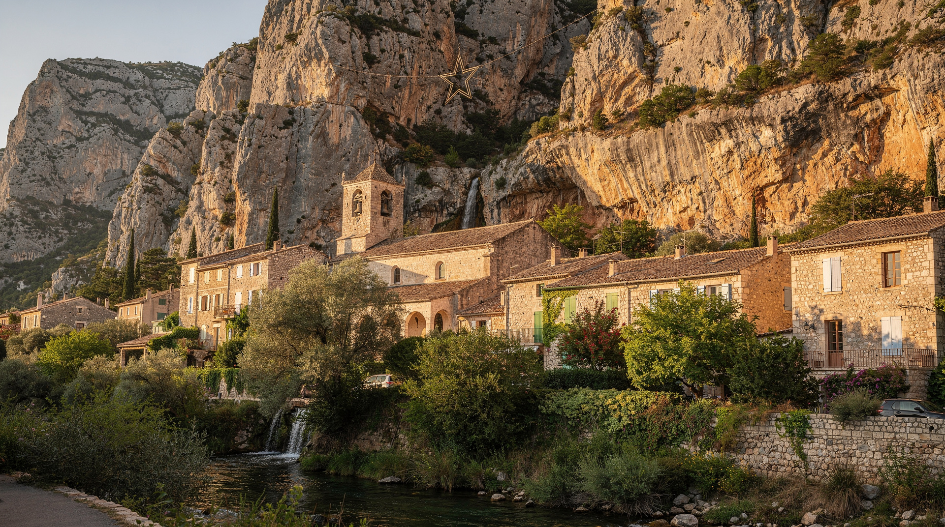
Recommended: One night in Moustiers-Sainte-Marie transforms the experience entirely. Arrive in the evening, walk the village, wake early for the gorge. The Sentier Blanc-Martel becomes feasible. The Sainte-Croix lake in the morning is uncrowded.
The Route des Crêtes
The Route des Crêtes (D952/D23) is the panoramic circuit road along the north and south rims of the gorge, linking La Palud-sur-Verdon with Aiguines and passing numerous belvedères (viewpoints) above the canyon. The full circuit is approximately 60 km and takes 2–3 hours with stops.
The viewpoints that reward stopping:
- Balcons de la Mescla (south rim): the confluence of the Artuby and Verdon rivers, visible from a 700-metre drop.
- Point Sublime (north rim, near La Palud): the classic high viewpoint into the deepest part of the gorge; the canyon walls here reach their maximum depth.
- Belvédère de l’Escalès (north rim): the view down to the Verdon river turquoise water is the most photographed in the gorge.
The road itself is narrow in sections — passing a campervan on the Route des Crêtes in opposite directions requires patience. In July–August, the road becomes crowded. Morning (before 10:00) or evening (after 17:00) are better for both traffic and photography light.
Sentier Blanc-Martel: the gorge floor hike
The Sentier Blanc-Martel is the classic canyon floor hike, descending into the gorge from Point Sublime (north rim) and emerging at the Chalet de la Maline 15 km later. It is not a loop — you need the shuttle to return.
Trail profile:
- 15 km, one way. Allow 5–7 hours of active hiking.
- Elevation: descends into the canyon (approximately 700 m drop from rim to river in sections), with sustained passages along the river level.
- The tunnel passages (you walk through two unlit tunnels; bring a headtorch) and the Brèche Imbert (a steep metal staircase of 250 metres of elevation on fixed iron rungs) are the most demanding sections.
- Dogs and mountain bikes are prohibited.
- Suitable for walkers with prior hiking experience and good fitness. Not recommended for beginners or young children.
Shuttle logistics: A shuttle bus connects the trailheads (Point Sublime and Chalet de la Maline) during the hiking season, April 4 to November 1. You must book at least 24 hours in advance at navette.parcduverdon.fr. Without a shuttle booking, the logistics of the one-way trail are complicated. Bookings open in late March; weekends in July–August fill quickly.
Best months: April–June and September–October. The canyon is shadowed for much of the day, which means it stays cooler than the plateau — an advantage in summer but a reason to bring a layer in spring and autumn.
Sainte-Croix lake
At the western end of the gorge, the Verdon flows into the Lac de Sainte-Croix — an artificial reservoir created in 1974 that is now 24 km long and one of the largest lakes in Provence. The water is the same turquoise as the gorge. The swimming is excellent. The visual reward of floating in electric-blue water with canyon walls visible upstream is one of the defining Verdon experiences.
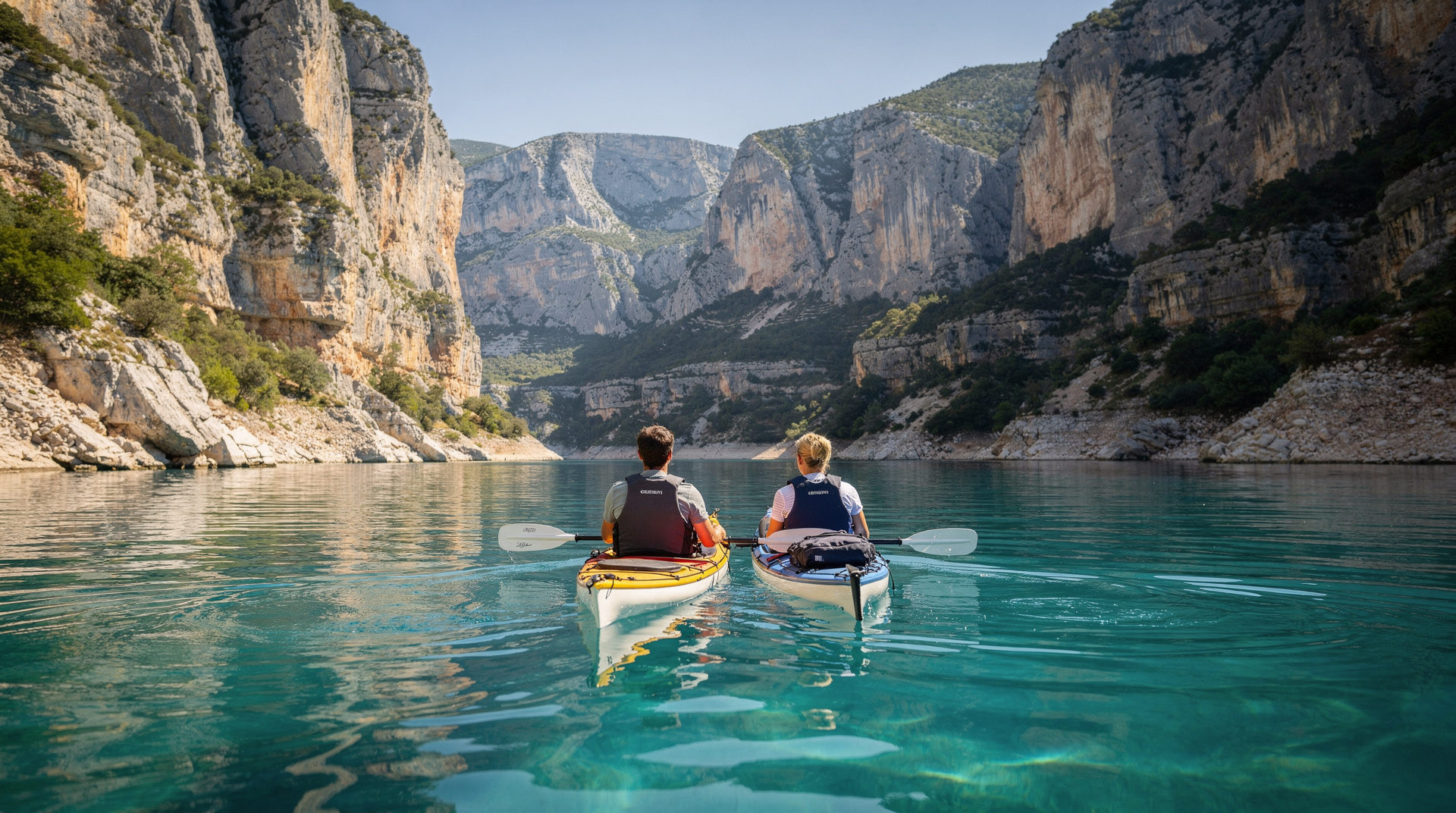
Kayak and canoe rental: Multiple operators at the lake entrance (particularly at the Pont du Galetas, where the Verdon river enters the lake) rent kayaks and canoes for self-guided paddling into the lower gorge. The entry section of the gorge — from the lake up into the first kilometres of canyon — is accessible without a guide. The turquoise narrows, accessible only by water, are extraordinary.
Kayak rental: Typical prices EUR 12–20 per hour per kayak. The section from Pont du Galetas into the gorge is around 2–3 km in and out — a 2-hour circuit. No experience required for the lake section; current increases further into the gorge and experienced paddlers venture further.
For a longer self-guided kayak through more of the gorge, see the canoe/kayak rental operators around Montpezat.
Where to base yourself
Moustiers-Sainte-Marie (see our Moustiers guide) is the natural base at the western entrance of the gorge — picturesque, well-supplied with restaurants and hotels, and 10 minutes from the Sainte-Croix lake.
La Palud-sur-Verdon (north rim) is the hikers’ village — smaller, less picturesque than Moustiers, but directly on the Route des Crêtes and the most practical base for the Sentier Blanc-Martel trailhead.
Castellane (east end of the gorge) is the main supply town — larger, with more accommodation options, supermarkets, and all practical services. Less atmospheric than Moustiers but useful for multi-day trips.
Practical considerations
Water and sun: The gorge provides some shade at midday, but the plateau rim roads are exposed. In July–August, temperatures reach 35–40°C on the plateau. Carry at least 2 litres of water per person for any hike; more in summer.
Mobile signal: Spotty in the gorge itself. Download offline maps before departure.
Accommodation in summer: Moustiers fills completely in July–August. Book months in advance. Shoulder season (May–June, September–October) has availability and is significantly more pleasant.
For the full context of visiting the western gateway to the gorge, see our Moustiers-Sainte-Marie guide. For day trip planning from Aix or Marseille, see day trips from Marseille.
The Verdon’s colour
The turquoise of the Verdon River has a precise scientific explanation that does not diminish its visual effect. The water carries very fine suspended limestone particles in colloidal suspension — so small that they scatter sunlight in the blue-green range of the spectrum, the Tyndall effect. This is the same phenomenon that colours glacial rivers in the Alps and fjords in Norway. The colour is most intense in summer, when the water level drops and the concentration of particles increases relative to volume.
In the lower sections of the gorge near Sainte-Croix lake, the suspended particles mix with the clear lake water to create gradients from pale turquoise to deep cobalt depending on depth. No filter is required.
Wildlife in the gorge
The Verdon is one of the last French habitats for several species:
Egyptian vultures and griffon vultures nest in the cliff faces of the gorge — the ledges and caves in the limestone walls provide undisturbed nesting sites. The vulture reintroduction programme has been running since the 1990s; griffon vultures are now regularly seen soaring above the canyon rim. Watching a vulture from the Route des Crêtes belvederes, in the thermal currents rising from the heated canyon floor, is one of the incidental pleasures of the drive.
Peregrines and eagle owls also nest in the gorge. Wildlife observation from the Route des Crêtes viewpoints in the early morning and late afternoon has the best chances of vulture and raptor sightings.
River otters have returned to the Verdon following protection of the river habitat — traces are more easily found than the otters themselves.
Flora: The gorge walls support specialist limestone cliff plants; the plateau is garrigue — cistus, lavender, thyme, rosemary — particularly striking in late spring when the flowering makes the limestone white with colour.
The Artuby bridge and the south route
The Route des Crêtes south of the gorge passes over the Pont de l’Artuby — a single-arch bridge 182 metres above the Artuby River gorge, one of the highest bridges in Europe and the site of France’s first and most dramatic official bungee-jump location. The bridge itself is free to walk across; the drop into the Artuby gorge below is vertiginous. Bungee operators work the site seasonally (typically April–October).
The south route from Aiguines to the Balcons de la Mescla takes approximately 1 hour 30 with stops. The Mescla viewpoint — where the Artuby joins the Verdon in a deep confluence — is the most dramatic single viewpoint on the south rim.
Multi-day Verdon itinerary
Day 1: Drive from Marseille or Aix to Moustiers. Evening in the village — star hike to Notre-Dame-de-Beauvoir, dinner, overnight.
Day 2: Early departure for Pont du Galetas. Morning kayak into the lower gorge (2–3 hours). Return to Moustiers for lunch. Afternoon Route des Crêtes (north rim, Point Sublime, Belvédère de l’Escalès). Overnight in La Palud-sur-Verdon if hiking next day.
Day 3: Sentier Blanc-Martel (shuttle booked in advance). 15 km, 5–7 hours. Return to Marseille.
This 3-day structure gives the gorge proper attention. The single-day version from Marseille works — but it is a drive day with a window in the middle, not an immersive experience.
Frequently asked questions about the Verdon Gorge
Is the Verdon Gorge worth the drive from Marseille?
Yes, if you can commit to an overnight or at minimum an early start and a genuinely full day. The gorge is one of the most spectacular natural landscapes in France and cannot be properly experienced in a hurried 4-hour visit at the end of a 2-hour drive from Marseille. With an overnight in Moustiers, it is outstanding.
Can I kayak the Verdon without experience?
The lower section (from Pont du Galetas into the gorge entrance and back) is suitable for beginners in calm conditions. The current is gentle in summer. Further into the gorge, the water becomes faster and more technical — guided tours or demonstrated experience is advisable beyond the first few kilometres. The full gorge descent (from Castellane to the lake) is an expert multi-day paddle.
When does the Blanc-Martel shuttle operate?
April 4 to November 1. Booking opens in the second half of March at navette.parcduverdon.fr. Book at least 24 hours ahead; weekends in July–August fill within days of opening. Dogs and bikes are prohibited on the trail.
What is the water temperature in Sainte-Croix lake?
The lake warms through June and reaches comfortable swimming temperature (18–22°C) by late June. It cools in September but remains swimmable through early October. The inlet from the gorge at Pont du Galetas stays cooler than the lake body — the turquoise canyon water mixing into the warmer lake is visually striking and slightly chilly.
Is one day enough to see the Verdon Gorge?
One day is enough to drive the Route des Crêtes and do a short kayak session at the lake, but it is not enough for the Sentier Blanc-Martel hike or a relaxed pace. If you have only one day and are coming from Marseille, prioritise the Route des Crêtes belvederes and a lake kayak over trying to fit in the full hike.
Do I need a car to visit the Verdon Gorge?
Effectively yes. There is no meaningful public transport network into the gorge or along the Route des Crêtes. Organised day tours from Aix or Marseille (such as the Aix–Verdon–Moustiers tour) are the practical alternative if you do not want to drive yourself.
When to go: month by month
| Month | Weather | Crowds | Notes |
|---|---|---|---|
| April–May | Mild, occasional rain | Low | Shuttle season opens April 4; wildflowers on the plateau |
| June | Warm, lake warming | Moderate, rising | Good balance of warmth and lighter crowds before the July surge |
| July–August | Hot (35–40°C on the plateau) | Very high | Book accommodation and shuttle slots weeks ahead; Route des Crêtes congested midday |
| September | Warm, cooling by late month | Moderate | Excellent hiking and driving conditions, lake still swimmable |
| October | Cooling, canyon shadowed early | Low | Last month for the shuttle (closes November 1); crisp light for photography |
| November–March | Cold, shuttle closed | Very low | Route des Crêtes still driveable in good weather; no Blanc-Martel hike |
Alternatives if the Verdon does not fit your schedule
If two hours each way from Marseille does not suit your itinerary, the Calanques National Park offers turquoise water and dramatic limestone cliffs within a much shorter drive, and Cassis pairs a similar visual drama with an easy train journey and no overnight required.
Travellers building a longer Provence loop often combine the Verdon with a stop in Moustiers-Sainte-Marie and the villages of the Luberon on the way back toward Aix. For a structured multi-day plan that includes the Verdon alongside other Provence highlights, see the 7-day Provence itinerary.
Geology of the Verdon Canyon
The Verdon Gorge is cut through the Jurassic limestone plateau of the Alpes-de-Haute-Provence. The canyon formed over millions of years as the Verdon River progressively incised through the plateau, following the tectonic uplift of the region during the Alpine orogeny. The limestone is from the Tithonian age (approximately 145–152 million years ago) — the same formations that form the Alpilles, the Calanques, and the backbone of the Provençal landscape.
The canyon walls display characteristic karst features: the white and grey layers correspond to different phases of marine deposition; the caves, alcoves, and overhangs reflect differential erosion of harder and softer limestone layers. The great overhang at the Escalès belvedere — where the cliff projects outward as visitors look down — is the result of a more resistant layer protecting the softer rock beneath from erosion.
This geology explains both the turquoise colour of the water (mineral dissolution from the limestone) and the stability of the cliffs for climbing and nesting (the harder Tithonian limestone provides reliable anchors and ledges).
Rock climbing in the Verdon
The Verdon is one of Europe’s most important limestone climbing destinations. The canyon walls offer hundreds of routes on vertical and overhanging faces, from multi-pitch classics to single-pitch sport routes accessible to intermediate climbers. The main climbing sector (the Escales sector, below the Belvédère de l’Escalès) is reached from the Route des Crêtes via a marked descent path.
Guide services based in La Palud-sur-Verdon offer day introductions and multi-pitch tours for climbers of all levels. The rock quality is generally excellent — compact, featured limestone with positive holds. The approach to the crag is typically a 30–45 minute descent from the road.
Climbing season: April–June and September–November. July–August the south-facing crags become extremely hot by midday; early morning and late afternoon climbing is the practice in summer.
Practical logistics: planning the Verdon visit
Car rental: If driving from Marseille or Aix, ensure your rental includes the autoroute charges for the A51 (toll road). The full circuit from Marseille via the A51 to Moustiers and back is approximately 380 km round trip — budget for fuel and tolls accordingly.
Navigation: The Route des Crêtes has variable mobile signal. Download the Verdon park offline map before departure. Paper maps (available at the Moustiers tourist office) are useful as backup.
Weather: Afternoon thunderstorms develop rapidly on the plateau in summer. If you are hiking or on the water, check the weather forecast the morning of your visit and be prepared to exit the gorge before afternoon if storm conditions develop. The Verdon is beautiful in rain but dangerous if lightning is developing over the canyon.
Combined Verdon and Moustiers planning: The combination of the gorge, Sainte-Croix lake, and the village of Moustiers is the standard Verdon experience. For this combination with overnight, Moustiers is the base. For a day-only visit from Aix, the Route des Crêtes drive plus a lake kayak session is the realistic scope. See our Moustiers-Sainte-Marie guide for the village detail.
The essential principle: The Verdon Gorge rewards slowing down. Those who drive the Route des Crêtes in 90 minutes, take a quick photo at Point Sublime, and return to the coast have seen the gorge’s dimensions but not its character. Those who kayak the lower canyon, watch the vultures from the belvedères in the late afternoon light, and wake in Moustiers the next morning to walk up to Notre-Dame-de-Beauvoir before the tour buses arrive — these visitors understand why the gorge is one of the exceptional landscapes of France. The difference is time, and time here requires an overnight.
Top experiences
Bookable activities with verified prices and instant confirmation on GetYourGuide.