En-Vau calanque hike from Cassis: routes, times, and what to expect
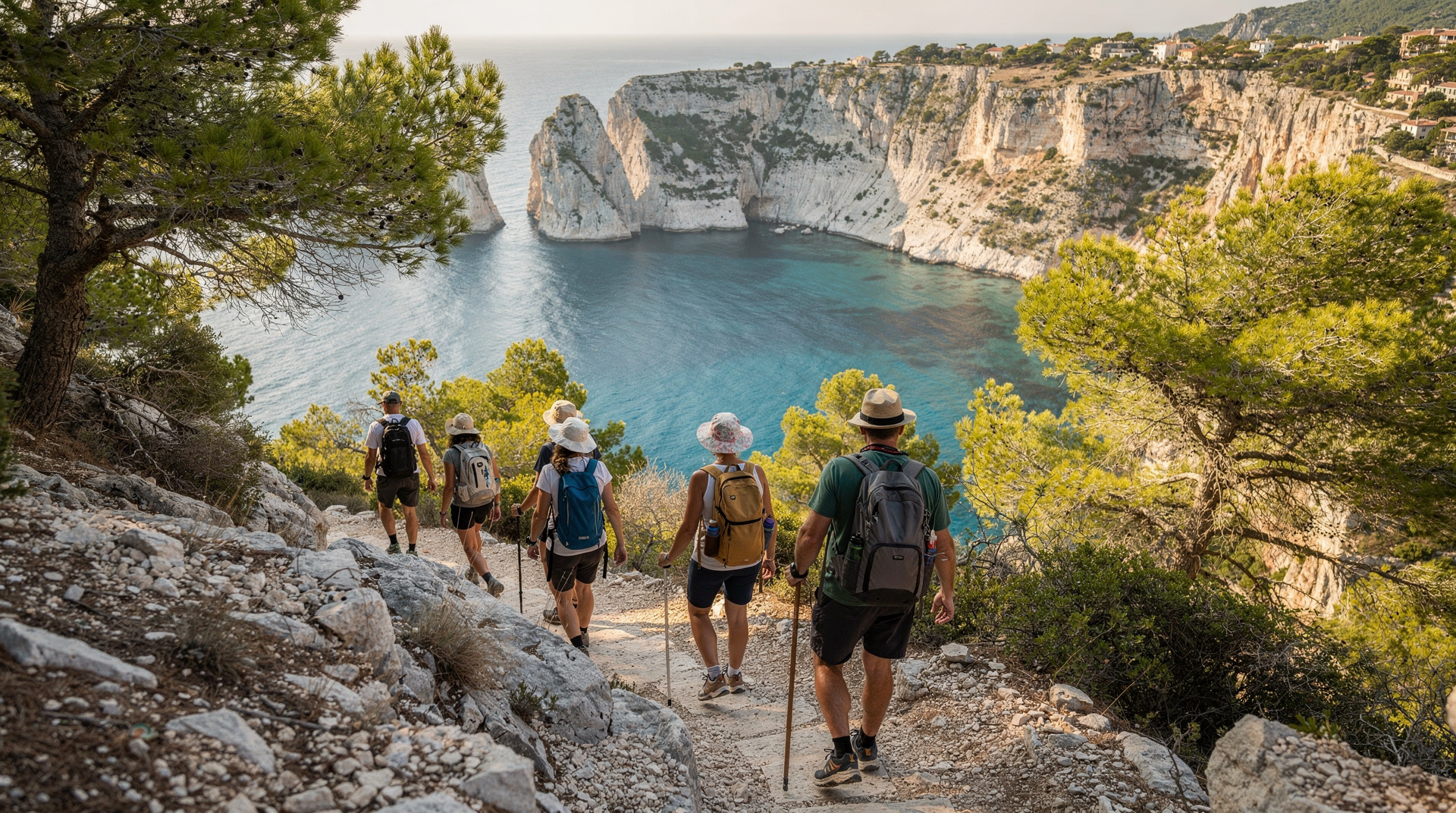
Cassis: 3 Calanques half-day hiking tour with swimming
How long is the hike to En-Vau from Cassis?
90 minutes to 2 hours one way at a moderate pace. The full round trip including Port-Miou, Port-Pin, and En-Vau is 4–5 hours. The descent into En-Vau is steep and requires proper footwear.
En-Vau: the calanque that earns its reputation
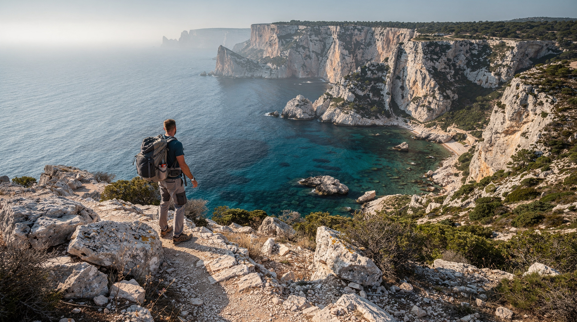
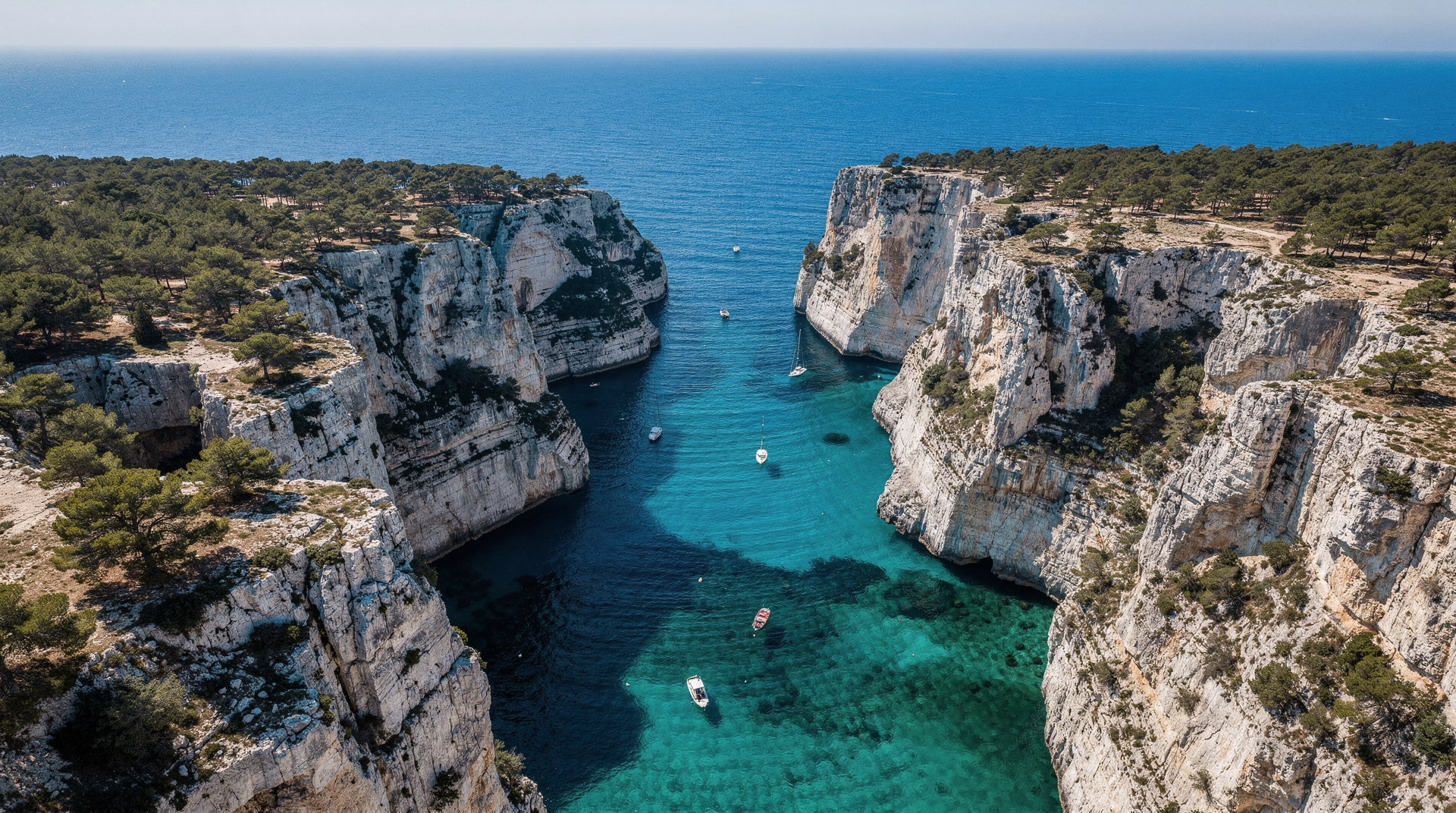
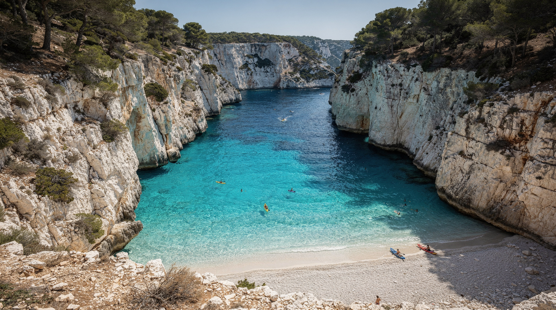
En-Vau is the most photographed calanque in the park, and the photographs are not misleading — they just cannot convey scale. The narrow slot between vertical white limestone cliffs, the emerald water pooled at the bottom, the geometric perfection of the cliff faces rising 120–150 metres on either side of a cove barely 50 metres wide: this is a landscape that reads as improbable even when you are standing in it.
Getting there honestly requires effort. The hike from Cassis is 90 minutes to 2 hours of real, uneven terrain. The final descent into the calanque is steep and requires attention. This guide gives you the exact routes, the real times, the alternatives when trails close, and what you will find when you arrive.
At a glance
| Where | From Cassis village, via Port-Miou and Port-Pin |
| One-way time | Around 90 minutes to 2 hours |
| Full round trip | Around 4-5 hours including stops |
| Cost | Free (public trail, no entry fee) |
| Getting to the start | ~35 min TER train from Marseille to Cassis, or drive |
| Best time | Early morning (before 09:00), May-June or September |
The two trail approaches from Cassis
Route 1: the coastal trail via Port-Miou and Port-Pin
This is the most walked approach and the most logical for visitors arriving from Cassis village. The trailhead begins at the eastern edge of the port, on the Rue des Calanques — 15 minutes’ walk from the centre.
Cassis port to Port-Miou (15 minutes): A flat, easy path along the edge of Port-Miou, the first and largest calanque — a long navigable inlet used as a marina. This section is not technically hiking; it is a walk on a broad, shaded path. Boats are moored on both sides of the inlet.
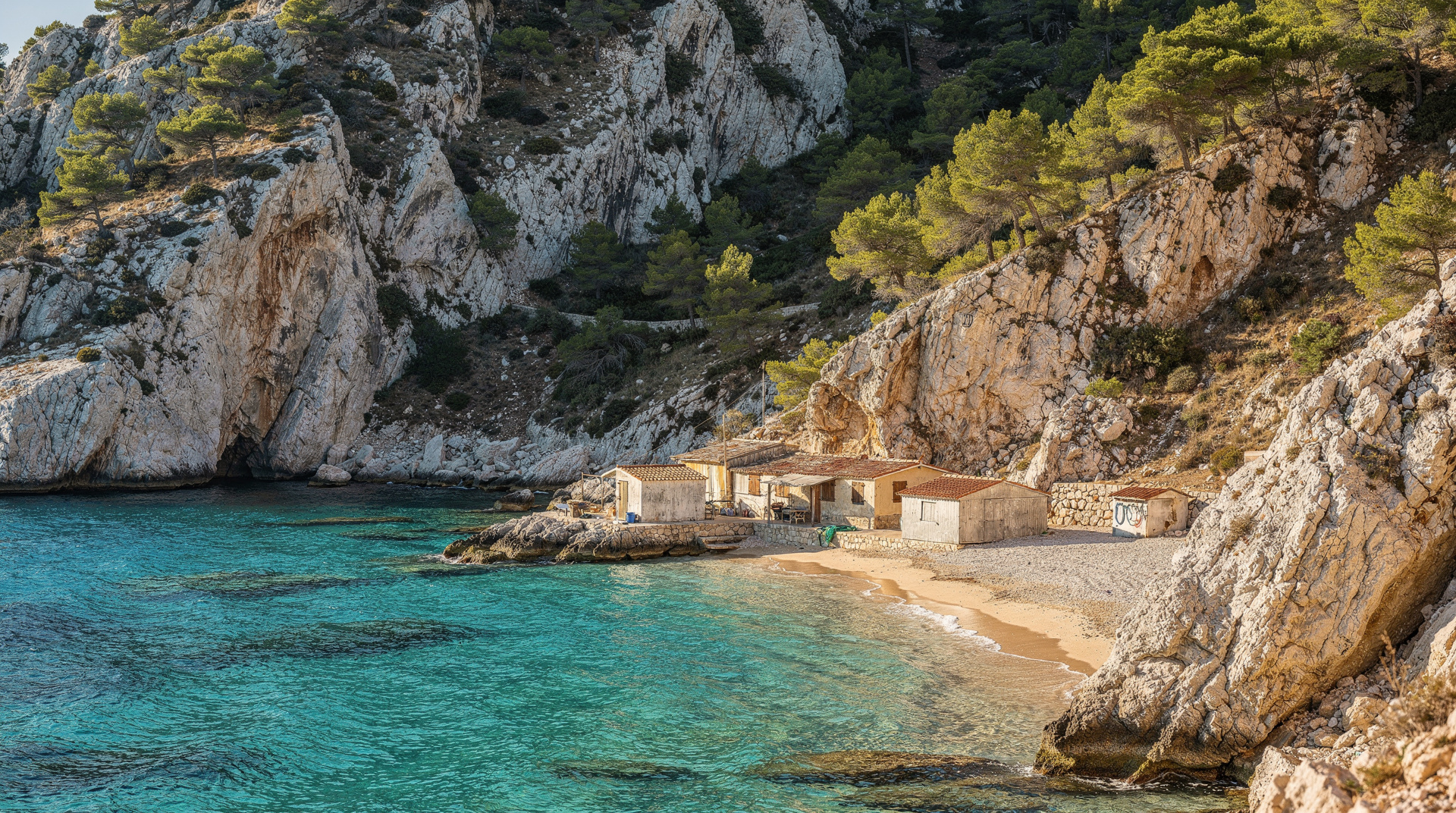
Port-Miou to Port-Pin (30–40 minutes): The trail begins climbing here. Rocky terrain, occasional scrambles over limestone slabs, views back to Cassis and Cap Canaille. Port-Pin arrives as a broader, calmer calanque with a proper pebble-and-sand beach and good swimming. This is the sensible stopping point for a half-day visit or for anyone in the group who is not confident on technical terrain.
Port-Pin to En-Vau (45–60 minutes): The hardest section. The trail climbs over a ridge — the Col de la Gardiole approach — before dropping toward En-Vau from above. The descent into the calanque from the col is steep, on loose rock and exposed limestone slabs. The final section requires care underfoot and is significantly harder when wet. This is the section where footwear matters most.
Total from Cassis village to En-Vau beach: 90 minutes to 2 hours at a moderate pace. Add 30–45 minutes for stops at Port-Pin.
Return: The return reverses the same route. Allow the same time or slightly more — the climb from Port-Pin back over the ridge is the tiring section. Full round trip from Cassis: 4–5 hours including time at the calanques.
Route 2: Col de la Gardiole direct approach
This intermediate approach bypasses the full Cassis coastal walk for walkers who specifically want to reach En-Vau with less total distance. The road to the Col de la Gardiole has been permanently closed to vehicles since 2019. The current access:
Parking: Logisson parking area on the D559 (Route de la Gineste), approximately 16 km southeast of Marseille city centre. Very limited spaces. No public transport.
From parking to En-Vau beach: Follow the paved Gaston Rébuffat road (closed to vehicles) to the Col de la Gardiole (30–45 minutes on foot). From the col, the trail descends to the En-Vau beach — 1 to 1 hour 15 minutes of descent. Total hike from parking: approximately 12 km round trip, 200m positive elevation, roughly 3 hours.
This approach is quieter than the Cassis route on busy days, but requires a car and offers less scenery en route (the coastal approach via Port-Miou and Port-Pin is far more rewarding). Most visitors should use Route 1 from Cassis.
The descent into En-Vau: what to expect
Both approaches converge at the col above En-Vau before the final descent. This descent is the most demanding section of either route:
- Steep rocky path with loose surface in the upper section
- Several exposed ledges requiring hands on rock for balance
- No fixed rope (unlike Sugiton’s descent — En-Vau relies on natural rock holds)
- The entry to the beach at the bottom is rocky, immediate, and slippery if wet
Going down is the exposure-rich direction. Coming back up is the aerobic challenge. Allow extra time and do not rush the descent — a twisted ankle at the bottom of En-Vau is a serious inconvenience requiring either self-rescue up the slope or helicopter rescue.
Footwear requirement: Hiking shoes or trail runners with proper rubber sole grip. This is not optional on the En-Vau descent. Smooth-soled shoes, sandals, or any footwear without ankle support will cause slipping on the polished limestone.
Fire risk closures and summer reality
The Cassis-side calanque trails (Port-Miou, Port-Pin, En-Vau) are subject to the same fire-risk closure system as the Marseille-side trails. The Bouches-du-Rhône prefecture issues daily access levels by 18:00 the previous evening. Orange and red levels in July–August close the trails.
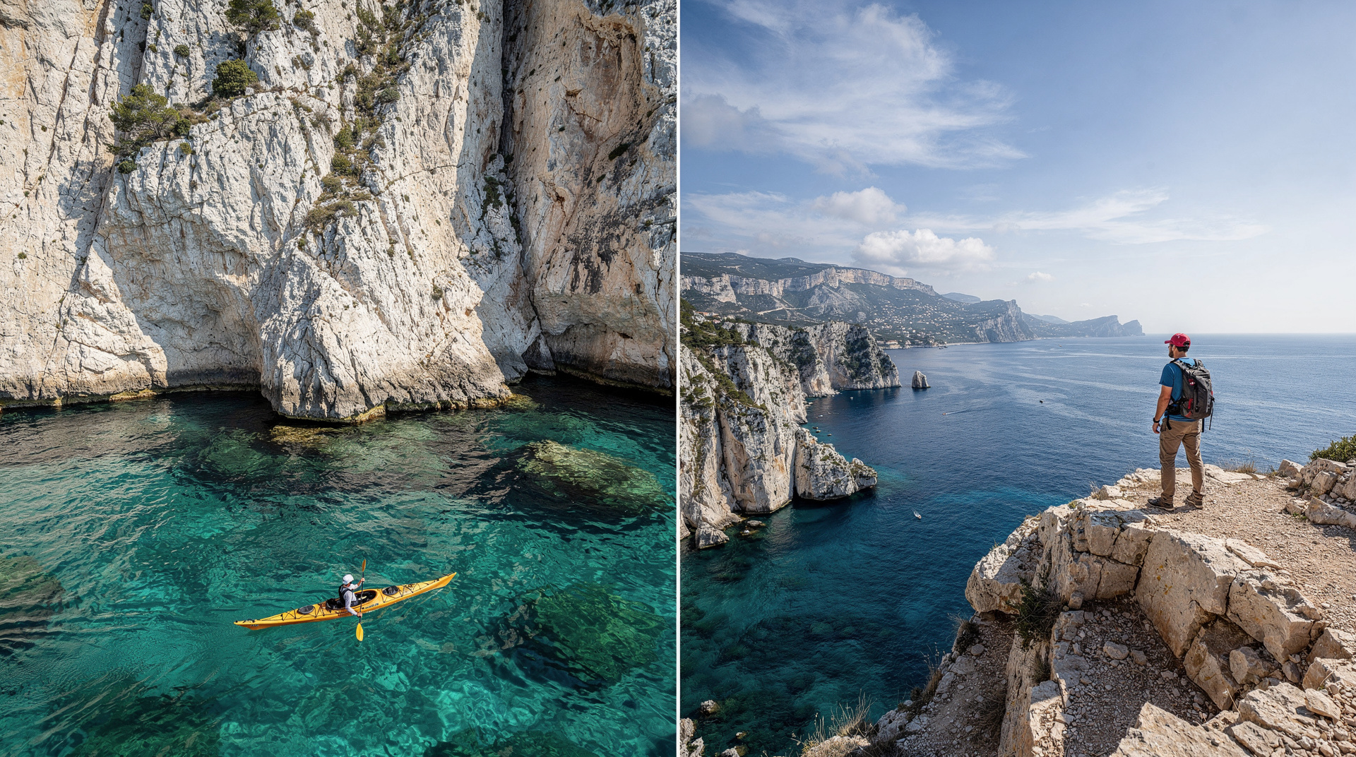
Sea access remains open regardless of terrestrial closures. Sea kayak and boat tours from Cassis reach En-Vau from the water whether or not the trails are open. The sea approach to En-Vau — paddling into the narrow slot with the cliffs rising on both sides — is the most dramatic single approach to any calanque in the park. See the kayaking guide.
Summer planning: If you are visiting in July or August and En-Vau is specifically your goal, book a kayak tour from Cassis as your primary plan. Build the hiking approach as a secondary option for days when access is confirmed green or yellow. Do not arrive at the trailhead in July assuming it will be open.
The Port-Pin variant: a smarter half-day choice
For many visitors, particularly those with children, those hiking in warm weather, or those who want a good swim without the technical commitment of the En-Vau descent, Port-Pin is the better stopping point.
Port-Pin has:
- A broader beach (pebble-sand, enough space to spread out)
- Easier water entry — the beach is accessible without the immediate-deep-water rocky entry of En-Vau
- Pines along the western cliff providing shade in the afternoon
- Calmer swimming conditions (the bay aspect is more sheltered)
Walking Cassis–Port-Miou–Port-Pin and returning is a 2.5–3 hour round trip that suits a wide range of fitness levels and avoids the most technically demanding terrain. If your group includes anyone not confident on steep loose rock, stop at Port-Pin.
Return by ferry: does it exist?
There is no scheduled public ferry service running between En-Vau and Cassis village. Boat tours from Cassis may pass En-Vau but do not stop to pick up hikers. The return is always on foot unless you have arranged private boat transport in advance.
However, some tour operators offer a one-way hike with a return ferry transfer — check with Cassis-based kayak and tour operators for current availability. This format is particularly useful for walkers who find the ascent from En-Vau easier in one direction.
Practical information for the En-Vau hike
Start time: Before 09:00. The calanque fills with boat arrivals from approximately 11:00 on peak days in June through September. Arriving at En-Vau at 07:30–08:30 means an hour in the cove with few or no other visitors before the first boats anchor offshore. A 12:00 arrival in July means sharing the cove with 15 boats, hundreds of swimming tourists, and no space on the pebble beach.
Water: 2 litres minimum per person. The trail has no water sources at any point. The Col de la Gardiole section in particular is fully exposed. Dehydration risk is real in June–September.
Swimming gear: Water shoes or fins are essential at En-Vau. The entry to the water is immediate rocky depth — sea urchins at the bottom, no sand, no gradual approach. Snorkelling in the cove is excellent: the sheltered water has visibility of 10–12 metres, and the underwater cliff faces descend into shadows where grouper and octopus shelter.
Return logistics: If you complete the full coastal round trip (Cassis–Port-Miou–Port-Pin–En-Vau–return), plan to be back at the Cassis trailhead no later than 16:00 to allow time for lunch before evening. The Cassis restaurants fill from 12:00; arriving late may mean no table.
The geology that made En-Vau
En-Vau’s geometry is not accidental. The narrow inlet was carved by a river system that existed before the last major sea-level rise — when the Mediterranean refilled approximately 5.3 million years ago, it drowned the river mouth. The limestone massif that forms the cliff walls is primarily Cretaceous in age, deposited 100 million years ago in a warm shallow sea. The white colour comes from the high calcium carbonate content; the horizontal banding visible in the cliff faces records distinct periods of deposition.
The cliff walls on either side of En-Vau are active climbing terrain — bolted routes of various grades ascend the faces from base to rim. In spring, climbers are visible on the walls during the early morning hours before the heat becomes prohibitive. The combination of the vertical limestone and the climbers in motion against it is one of the more striking visual elements of an En-Vau morning.
The marine environment at the base of the cliff is part of the Calanques National Park marine reserve. The water clarity (typically 10–15 metres visibility) results from the absence of river runoff, the limestone substrate that doesn’t release fine sediment, and the reserve protections that have maintained the ecosystem. The green colour that characterises En-Vau’s enclosed water (distinct from the more vivid turquoise of wider, shallower coves) comes from the depth and the shadow cast by the cliff walls — light penetrates the surface water and reflects off the pale limestone bottom, but the deeper sections absorb the longer wavelengths first.
Wildlife in and around En-Vau
The cliff faces above En-Vau are nesting habitat for blue rock thrush and Alpine swift. Peregrine falcons have been recorded on the upper limestone faces. At the water level, sea bass and bream are visible in clear conditions — the boulder base of the cliff provides the sheltered structure that predatory fish prefer. Sea urchins coat the rocky bottom at the calanque entry; the density is high enough that water shoes are genuinely necessary rather than merely advisable.
The garrigue vegetation above the trail has good populations of green lizards and Montpellier snakes in spring. The Montpellier snake is the most common snake in the Calanques and is harmless to humans (its rear-fanged venom is effective on lizards, not on large mammals). If you see one crossing the path, it will disappear before you can do anything other than note its length (they reach 1.5–2 metres) and the characteristic dark back pattern.
After En-Vau: extending the day
If you have arrived at En-Vau and have time and energy remaining, two options extend the day productively:
The Cap Sugiton ridge (1.5 hours additional): From the En-Vau col, a trail traverses the ridge toward Sugiton on the Marseille side of the massif. This is a serious extension of the day — add 1.5–2 hours round trip from En-Vau. It requires confirmed trail access status and adequate water (add 1 litre per person for this extension).
Return via Port-Pin with lunch stop: Rather than climbing directly back over the col, many walkers time the return to Port-Pin at midday and spend 45–60 minutes on the beach there eating lunch before the final climb back to Cassis. Port-Pin’s pebble beach has enough flat rocks for a comfortable sit-down lunch; the aspect means shade arrives on the western cliff by early afternoon.
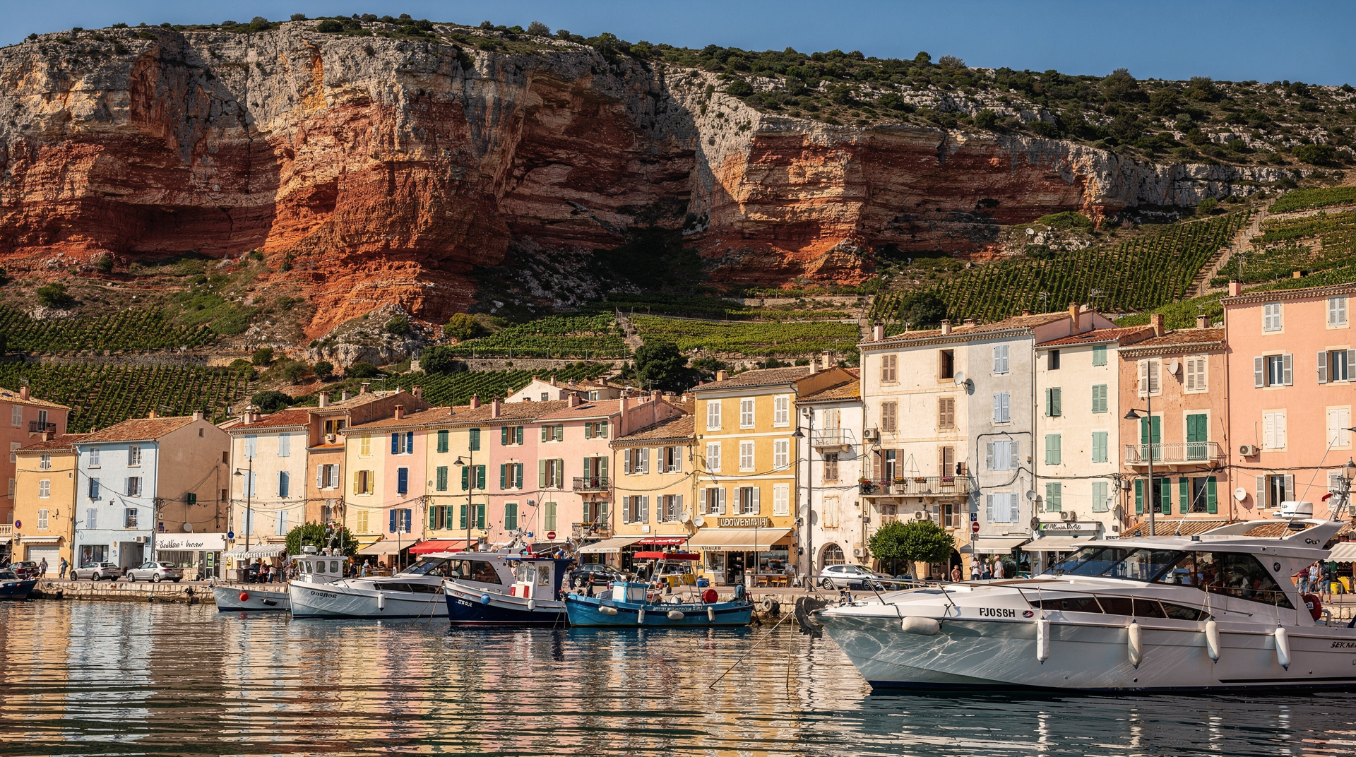
Cassis lunch at the port: Arriving back in Cassis village around 13:00–14:00 puts you at the port restaurants during the prime lunch window. Cassis port restaurants are strong on fresh grilled fish and local AOC white wine. A table on the terrace after a 5-hour morning hike is a specific Cassis pleasure. The local wines — Marsanne-based whites from the AOC appellation — pair with fish in a way that the lazy cliché of “wine and local cuisine” actually delivers on here. See the Cassis guide for restaurant orientation.
Getting to Cassis without a car
The TER train from Marseille Saint-Charles to Cassis station takes approximately 35 minutes. Frequency varies — check the SNCF schedule for your date. From Cassis station, a taxi to the port costs approximately EUR 10–12 (3 km). The trailhead is then 15 minutes’ walk from the port. Car-free access to the En-Vau hike via Cassis is entirely practical.
For the full context on En-Vau and Port-Pin as destinations, see the En-Vau and Port-Pin guide and the Cassis destination guide. For comparison with the Marseille-side calanques and which to choose for a first visit, see Cassis vs Marseille Calanques. For safety guidance specific to summer hiking, read Calanques hiking safety. The difficulty comparison guide puts En-Vau in context against the other main Calanques hikes.
En-Vau vs Port-Pin vs the sea approach: which to choose
| Option | Effort | Reward | Best for |
|---|---|---|---|
| Full hike to En-Vau | High (steep descent both ways) | The signature narrow-cliff calanque | Confident hikers, proper footwear |
| Stop at Port-Pin | Moderate | Broad beach, easy swimming, still scenic | Families, anyone unsure about the descent |
| Kayak/boat from Cassis | Low physical effort | Sea-level view into En-Vau’s slot | Trail closure days, non-hikers, hot weather |
Frequently asked questions about En-Vau calanque hike from Cassis
Is the En-Vau hike suitable for children?
The full hike to En-Vau, with its steep final descent over loose rock and exposed ledges, is demanding for young children and not recommended for anyone unsteady on uneven terrain. Port-Pin, reached via the easier first two sections of the same trail, is a much better family target — see the Port-Pin variant above. Older children (roughly 10+) who are confident on rough terrain and wearing proper hiking shoes can usually manage the full route with a slow pace and close supervision on the descent.
Can I swim at En-Vau, and is it worth the hike just for that?
Yes, and the swimming is excellent — clear, sheltered, cool water at the base of dramatic cliffs. Whether the hike is “worth it just for swimming” depends on your hiking tolerance: if you’d enjoy 90 minutes to 2 hours of real trail walking either way, the swim is a superb reward. If you only want the swim without the effort, a kayak or boat tour from Cassis reaches the same water with far less physical demand — see the kayaking guide.
Top experiences
Bookable activities with verified prices and instant confirmation on GetYourGuide.