Calanques hiking safety: the honest guide to risks and how to avoid them
Marseille: Calanques National Park guided hike
Duration: 5 hours
Is it safe to hike in the Calanques in summer?
Not without specific precautions — and not at all during fire-risk red alerts. Heat exhaustion and dehydration are the primary risk. Most trails close July–August. The safe hiking windows are April–June and mid-September–October, with early starts (before 8:00) from June onward.
The real picture: heat kills hikers here
The tone of most Calanques hiking guides is aspirational — turquoise water, white cliffs, extraordinary views. That is all accurate. This guide is the one that tells you what the emergency services deal with every summer season, because that information is how you avoid becoming one of those cases.
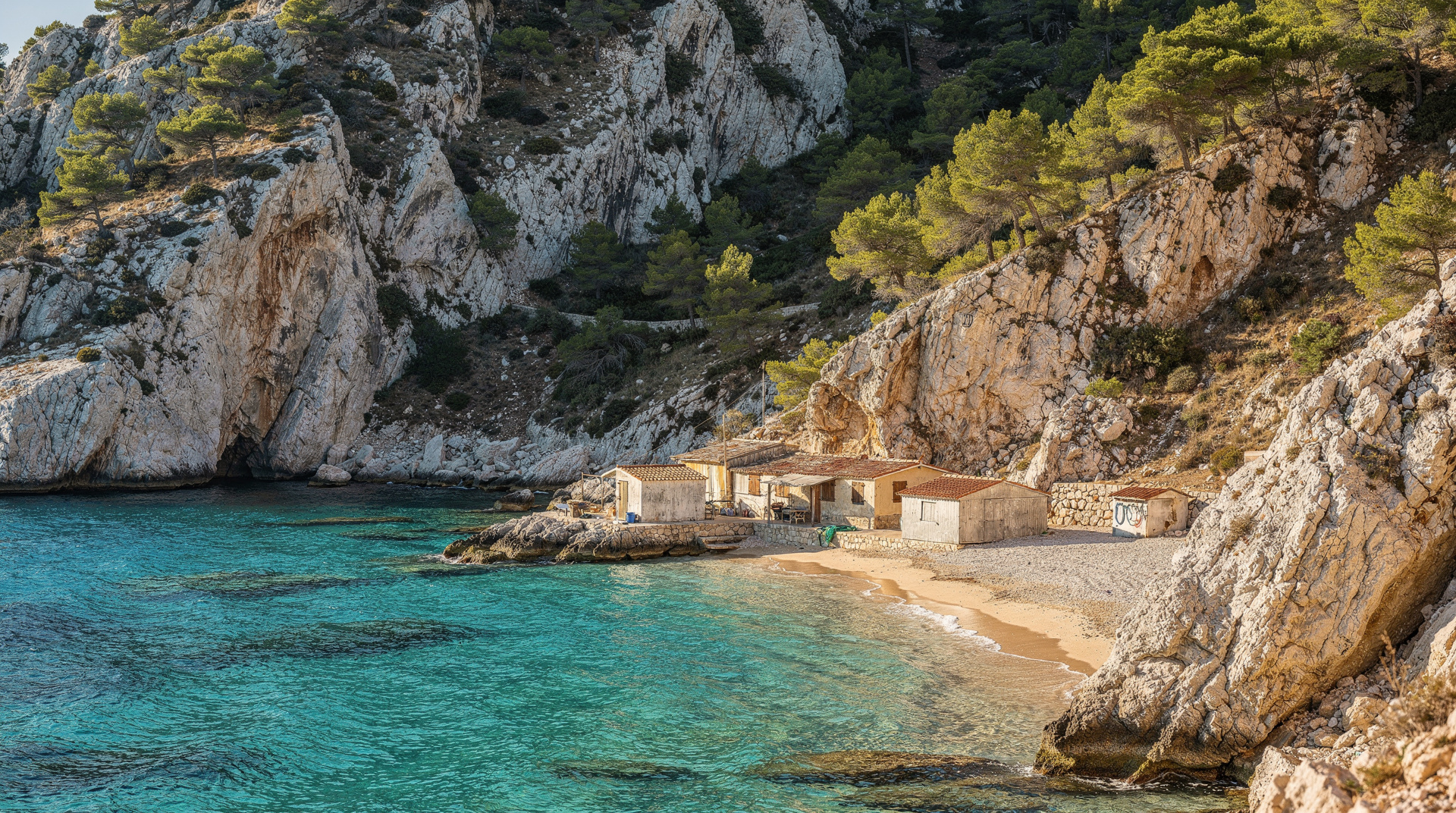
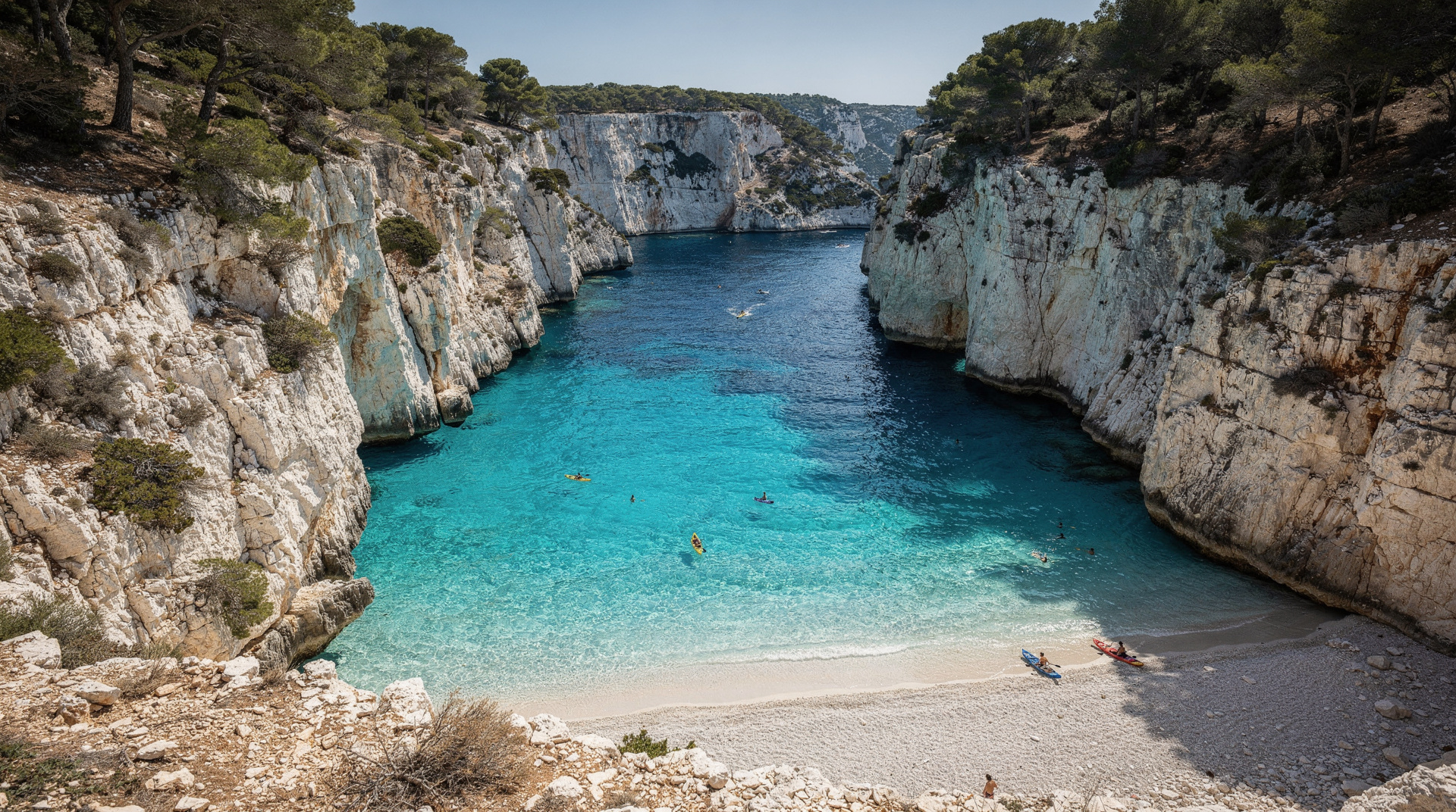
Heat exhaustion and hyperthermia kill walkers in the Calanques most years. The environment is extreme: exposed white limestone that reflects rather than absorbs heat, no shade on most trails for extended sections, no water sources at any point, temperatures regularly exceeding 35°C in July and August, and a sea that looks accessible from above but requires significant exertion to reach and return from. The combination catches walkers who have not been in similar conditions before.
This is not a reason not to hike the Calanques. It is a reason to understand the actual conditions before you go, and to adjust your plans accordingly.
| At a glance | |
|---|---|
| Main risk | Heat exhaustion/heatstroke, dehydration, falls on polished limestone |
| Emergency number | 112 (works EU-wide, no SIM required); 114 for SMS |
| Water needed | Around 2 litres minimum per person from May onward, more in summer |
| Safest months | April-June and mid-September to October |
| Check before leaving | calanques-parcnational.fr or the Mes Calanques app, after 18:00 the evening before |
Safety by season: what changes across the year
| Season | Heat risk | Trail access | Water carried |
|---|---|---|---|
| April-June | Low to moderate | Generally open (green/yellow) | Around 2 litres |
| July-August | Severe | Frequently closed (orange/red) | 3+ litres, early start essential |
| September-October | Moderate, dropping | Reopens progressively | Around 2 litres |
| November-March | Low | Open, minimal crowds | 1-1.5 litres |
The fire closure system: how it actually works
The most important safety mechanism in the Calanques is the fire risk closure system, and it operates in ways that most visitors do not understand until they arrive at a closed barrier.
Who sets the closures: The Préfecture des Bouches-du-Rhône, based on a daily meteorological assessment. The relevant factors are temperature, humidity, and especially wind speed and direction. A mistral wind in dry conditions at 30°C creates extreme fire risk almost instantly.
When the assessment happens: Between 17:00 and 18:00 each day, the prefecture evaluates conditions and publishes the access level for each forest massif in the department for the following day. The update is available by approximately 18:00 on calanques-parcnational.fr, on the Mes Calanques app, and on the prefecture website (bouches-du-rhone.gouv.fr — look for “Accès aux massifs forestiers”).
The four access levels (updated for 2026):
- Green: Unrestricted access. All trails open.
- Yellow: Access permitted with caution. Some higher-risk zones may have specific restrictions. Read the specific instructions for your destination.
- Orange: Significant restrictions. Specific trails and zones are closed. Boat access may be restricted in some areas. Check exactly which areas are affected — not all of the Calanques massif necessarily closes simultaneously.
- Red: All terrestrial access to the Calanques and other classified massifs is prohibited. This means no hiking, no car access to the massif roads, no entry on foot from any direction. Boat access is possible but landing at calanques is prohibited. Sugiton reservations for that day are automatically cancelled.
What red level means in practice: You cannot legally enter the massif at all. Park wardens and gendarmes enforce this at the Luminy access point and at the road barriers. The fine for ignoring a red-level closure is significant. More importantly, the closures exist because the fire risk is genuine — the major Calanques fires of the post-war period each started from a small ignition source in similar conditions.
The practical implication: Check calanques-parcnational.fr after 18:00 the day before any planned hike. Do not rely on the previous day’s status. A green day can follow a red day, and a red day can follow a green day, depending on overnight wind shifts.
Heat: the primary risk factor
The Calanques landscape concentrates heat. White limestone reflects ultraviolet radiation. The trails are exposed ridgelines with minimal canopy. Air temperature at trail level in July regularly reads 32–38°C, but the effective temperature at ground level on the rock can be 5–8°C higher.
The mechanism of heat illness:
- Heat exhaustion: The early stage — excessive sweating, weakness, dizziness, nausea, pale and clammy skin, headache. Treat by stopping immediately, moving to the most shaded location available, drinking water slowly, cooling the skin with damp clothing.
- Heat stroke: The emergency stage — hot dry skin (sweating has stopped), confusion, rapid pulse, loss of consciousness. This is a medical emergency. Call 112 immediately. While waiting, cool the person by any means available (wet clothing, shade, fanning).
The transition from heat exhaustion to heat stroke can happen faster than most people expect, particularly in those who are already slightly dehydrated from the walk in.
Who is at elevated risk: Those over 60, children under 5, anyone with cardiovascular conditions, anyone who did not hydrate properly before starting, anyone wearing dark or synthetic clothing that absorbs heat.
Water: the exact numbers
The standard advice says “bring plenty of water.” Here is the specific version:
At 20°C (comfortable spring morning): 0.5 litres per hour of active hiking per person.
At 25°C (typical May–June morning): 0.75 litres per hour.
At 30°C (June–early July): 1 litre per hour minimum. A 3-hour round trip to Sugiton requires 3 litres per person. A 5-hour round trip to En-Vau from Cassis requires 4–5 litres per person.
At 35°C (peak summer, which is when you should not be hiking): 1.5+ litres per hour.
There are no water sources anywhere on the trails. No fountains, no streams, no emergency water points. The sea at the calanque at the bottom of a 45-minute descent is not a water source — do not drink seawater. The single restaurant at Sormiou (Les Tamaris) is not reliably open and is accessible by reservation; you cannot plan to buy water there.
Practical rule: Each person carries 2 litres minimum for any Calanques hike from May onward. This is not being overcautious — this is the minimum required for a moderate hike in typical early-season conditions. Double it for June and beyond.
Footwear: why it matters here specifically
The Calanques trail surface is a combination of polished limestone (smooth and potentially slippery when damp), loose scree sections, rock ledges with abrupt drops, and occasional path that has been worn into bare rock. The specific risks:
Slipping on polished limestone: Smooth-soled shoes (including many trail shoes, fashion trainers, and any sandal) slide on wet or damp limestone. The rope section at Sugiton, the descent to En-Vau, and the rocky sections on the Sormiou–Morgiou ridge have all caused falls from inappropriate footwear.
Ankle injuries from loose scree: The scree sections on many descent paths are unstable under foot. A shoe without lateral ankle support allows the foot to roll outward — the most common ankle injury mechanism. Proper hiking shoes (not trail runners, not cross-trainers) with a reinforced upper provide this support.
Sea urchin injuries at the water: Not a hiking risk, but an end-of-hike risk — the rocky entries to the calanques have sea urchin populations at depth. Water shoes or fins for the swimming section prevent the painful and sometimes infected wounds that sea urchin spines cause.
Minimum acceptable footwear for Calanques hiking: A rubber-soled hiking shoe or trail runner with a grippy tread and some ankle support. Sandals, flip-flops, flat trainers, and fashion sneakers are inadequate.
When to bail: the decision framework
Conditions in the Calanques can change more quickly than in most hiking environments. The mistral wind can go from 0 to 60 km/h in under an hour. Temperature can spike 8°C in 30 minutes as cloud cover dissipates. Here are the specific conditions under which turning back is the right decision:
Turn back immediately if:
- The access status changes to orange or red after you have started (check your phone periodically)
- Anyone in the group shows signs of heat exhaustion (dizziness, nausea, confusion)
- You have consumed more than two-thirds of your water before reaching the calanque
- A mistral-strength wind develops on a ridge section — wind combined with heat creates rapid dehydration, and the exposed limestone ridges are no place to be in a 60 km/h wind
- Thunderstorm conditions approach — lightning on exposed limestone ridges is a genuine risk, and the routes cannot be exited quickly
Turn back now if:
- It is after 13:00, you have not yet reached your destination, and it is above 28°C — the return leg in afternoon heat with diminished water supply is the scenario that creates emergencies
Do not turn back if: You are simply tired and the conditions are safe. The exhausted return uphill from En-Vau or Sugiton is unpleasant but not dangerous if you have water, are not overheating, and are moving at a pace you can sustain.
What to do if someone is injured
Assess the situation first: Is the person conscious? Can they move the injured limb? Can they bear weight?
For a twisted ankle or minor injury: Get the person to the most stable and shaded position. If weight-bearing is possible after 10 minutes of rest, a slow exit on foot may be feasible — take the shortest route back to the trailhead. If not weight-bearing, call for help.
For a serious injury or medical emergency: Call 112 (European emergency number, works throughout France). The PGHM (Peloton de Gendarmerie de Haute Montagne — mountain rescue based in Marseille) operates in the Calanques. Give your location as specifically as possible — name the calanque, describe your position relative to the beach (at the water, on the trail, at which section). If GPS coordinates are available, read them out.
Mobile signal in the Calanques: Patchy and inconsistent. The ridge areas often have adequate signal; the calanque floors (below the cliffs) may have none. If you cannot reach 112, climb back toward the ridge and try again. If still no signal, send someone in the group to climb to a position with signal. Do not leave an injured person alone unless absolutely necessary.
Helicopter rescue: The PGHM conducts helicopter evacuations from the Calanques. They need a clear landing area — the calanque floors are generally adequate. A helicopter evacuation is not a failure — it is the system working. Call early rather than late.
Safe hiking in the Calanques: a summary checklist
Before you leave:
- Check access status at calanques-parcnational.fr (after 18:00 the day before)
- Check the weather forecast: temperature, wind, any storm risk
- Carry 2 litres of water per person minimum (3+ for June–September)
- Wear hiking footwear (not sandals, not flat trainers)
- Have sunscreen, a hat, and sunglasses
- Tell someone your planned route and expected return time
- Download the Mes Calanques app and save an offline map
On the trail:
- Start before 9:00 from June onward; before 7:00 in July–August on open days
- Do not hike alone in the interior massif on a warm day
- Monitor water consumption — if you reach halfway with less than half your water, consider turning back
- Do not rely on finding shade at the calanque — plan for a shaded rest en route
At the water:
- Use water shoes or fins for rocky entries
- Do not swim out of sight of the group
- Do not jump from rocks without verifying depth — the Calanques have specific jumping spots, but they are not all safe
For safety during boat access as an alternative, see the boat tours with swimming guide. For the full hiking trail system, see the Calanques hiking master guide. For the specific summer access situation, see Marseille in summer and the Calanques National Park guide.
Matching the route to your conditions
Safety is largely a question of choosing the right walk for the day, the season and the group. Before you commit, read the best Calanques hikes by difficulty guide and pick a route that sits comfortably below your fitness level rather than at its edge. If you are still deciding where to go, which Calanque to visit helps you weigh effort against reward.
The walks to Sugiton and En-Vau each have their own particular hazards, and the dedicated Sugiton hike guide and En-Vau hike guide describe the exposed sections you should expect. If you would rather start from the western side, the Sormiou hike guide covers that approach. Anyone considering the long walk between the two towns should read the GR98 Marseille to Cassis guide with this safety page open beside it, because a long day multiplies every risk described above.
Timing matters as much as the route. The visiting the Calanques by season guide shows how conditions shift through the year, and avoiding crowds in the Calanques explains why an early start is good for your safety as well as your peace and quiet.
If the forecast, the access level or your group makes walking a poor idea, there are good alternatives. A boat-versus-hike comparison helps you decide, and the Calanques boat tour guide explains how to see the cliffs from the water. Families should also look at the kid-friendly Calanques guide before bringing children onto any trail.
Frequently asked questions about Calanques hiking safety
Are the Calanques dangerous to hike?
Not inherently, but they are demanding in ways that are easy to underestimate — particularly regarding heat and water. The terrain is rocky and requires attention, but it is not technical climbing. The real risk is environmental: the combination of heat, exposure, and no water sources on trails makes heat illness the primary danger, and that risk is entirely manageable with preparation.
What is the emergency number in France?
112 — works across the EU on any mobile network, including without a SIM card. For mountain rescue specifically in France, 114 is the SMS-based emergency number for people who cannot speak (which may apply in areas of poor signal where data works but calls do not).
Has anyone died hiking the Calanques?
Yes. Heat-related deaths and serious injuries occur in the Calanques in most summer seasons. The national park does not publicise individual incidents, but the PGHM mountain rescue service reports periodic interventions for hyperthermia and hiking accidents. These incidents typically involve late starts, insufficient water, or hiking during high-risk temperature conditions — all avoidable.
Should I hire a guide for my first Calanques hike?
It is strongly recommended for a first visit, particularly if you are hiking in June–September. A local guide monitors the daily access map as professional practice, knows which trails are least crowded on a given day, carries emergency equipment, and can make real-time decisions about route changes if conditions shift. The ecological context a good guide provides also makes the experience substantially richer.
How do I find out about trail closures in real time on the day?
The Mes Calanques app updates the access status for each zone. Alternatively, calanques-parcnational.fr shows the current day’s access level. If you are already on the trail and a closure is announced (a warden may inform you, or you may see it on your phone), the correct response is to return to the trailhead by the most direct route.
Is the Luminy trailhead the safest place to start a first Calanques hike?
It is a reasonable choice because it is the highest-traffic entry point, with the most consistent warden presence and mobile signal on the ridge sections. See the Luminy gateway guide for the specific approach details before you set out.
Top experiences
Bookable activities with verified prices and instant confirmation on GetYourGuide.