Cap Canaille hike: France's highest sea cliff above Cassis
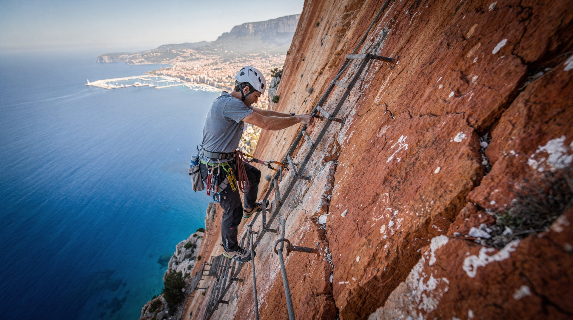
Cassis: via ferrata on the Cap Canaille
Duration: 4.5 hours
Can you hike to the top of Cap Canaille?
Yes — from Cassis village, a hike via the Route des Crêtes reaches the Cap Canaille summit (394m) in 2–3 hours. The drive along the same corniche road takes 30–45 minutes and reaches the same viewpoints. The via ferrata ascends the cliff face directly.
The highest coastal cliff in France
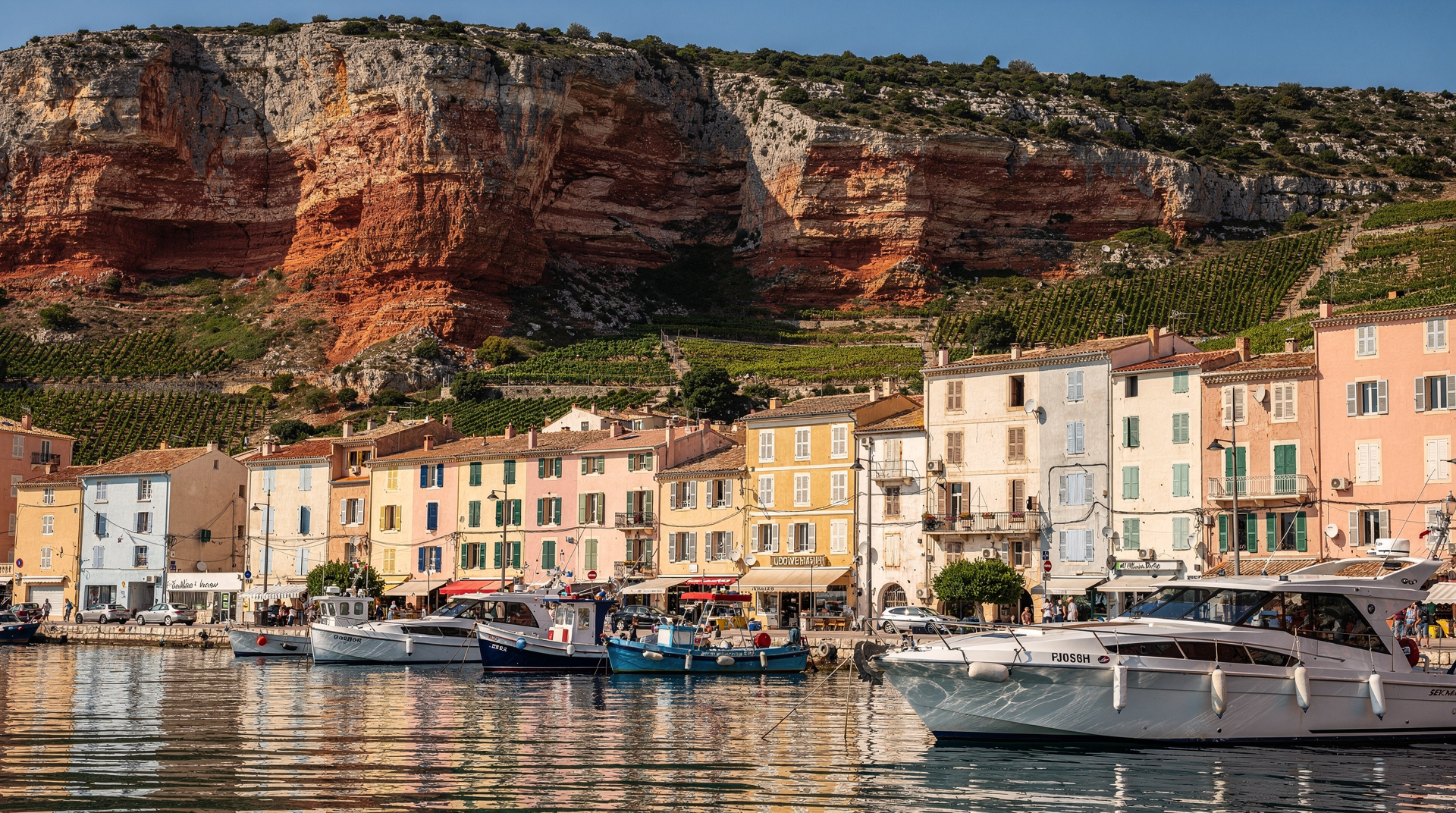
Cap Canaille is the headland that closes the eastern side of Cassis — a wall of orange-red limestone rising 394 metres from the Mediterranean to a summit plateau from which the view extends across the Calanques to Marseille in one direction and along the coast toward La Ciotat and the Toulon peninsula in the other. It is the tallest coastal cliff in continental France, and one of the more spectacular single viewpoints in southern Provence.
The cliff face itself is not limestone white but an ochre-orange-red rock — different in colour and composition from the bleached limestone of the Calanques massif immediately west. The contrast between the two cliff systems, visible from any boat in the bay, tells the geological story of a boundary between two different formation periods.
There are three ways to experience Cap Canaille: drive the Route des Crêtes corniche, hike from Cassis village, or climb the cliff face via ferrata. This guide covers all three honestly.
| At a glance | |
|---|---|
| Where | Headland east of Cassis village, on the Route des Crêtes toward La Ciotat |
| Cost | Free to view (Sémaphore car park and hiking trails); the via ferrata is a paid guided session |
| Time needed | 45 min–1 hr by car; 4–5 hrs return on foot from Cassis; a half or full day for the via ferrata |
| Getting there | Drive or taxi from Cassis (around 15 min to the summit); on foot via the Route des Crêtes from the village |
| Best time | Clear winter or spring mornings for the longest visibility; avoid windy days for the via ferrata |
The Route des Crêtes: drive or walk?
The Route des Crêtes is a scenic corniche road that loops from Cassis over the cap and descends to La Ciotat, with viewpoints at the summit and along the cliff edge. It is 14 km by car between Cassis and La Ciotat via the Crêtes — allow 45 minutes to an hour including stops at the main viewpoints.
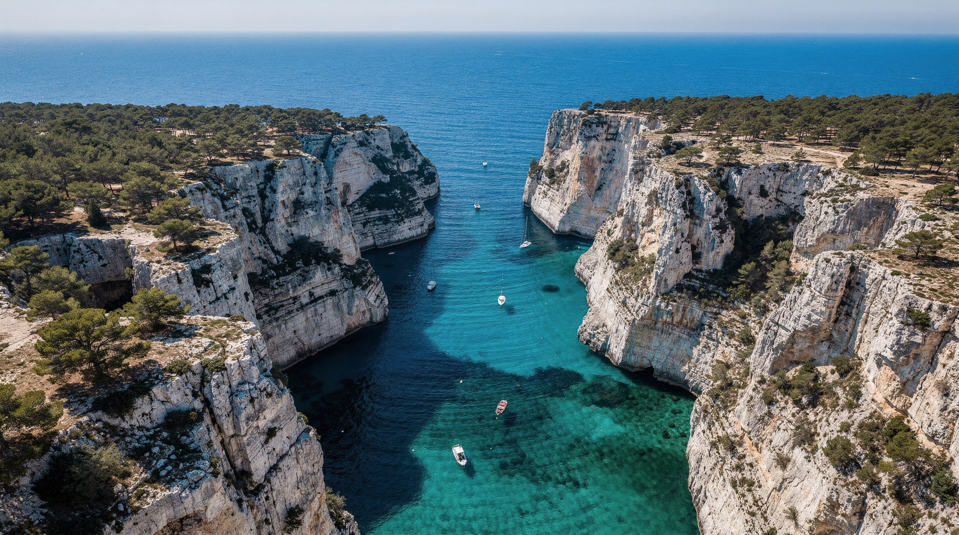
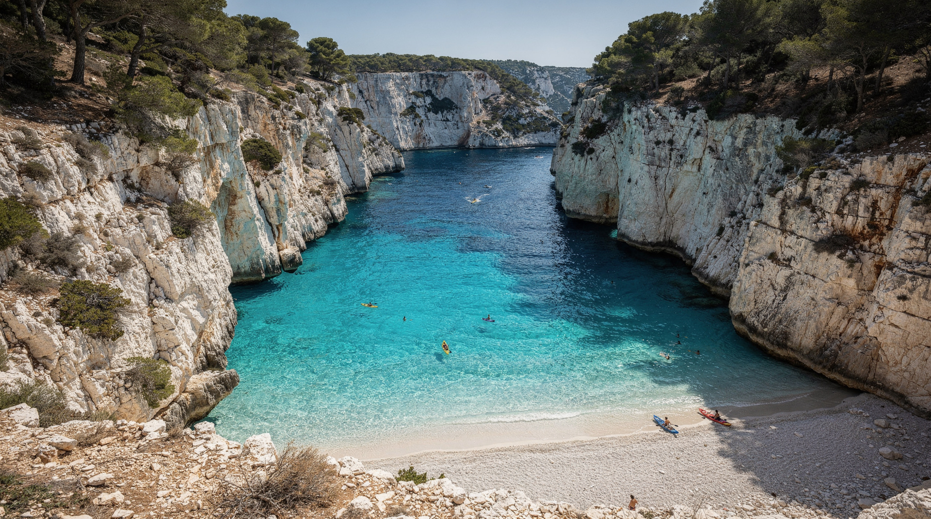
Drive option (most visitors): Practical, accessible to all ages and fitness levels, and delivers the primary reward — the view from the Sémaphore viewpoint near the summit is exceptional. From this point, the white cliffs and turquoise water of the Calanques National Park are visible stretching west to Marseille. The Frioul Islands and Château d’If are typically visible on clear days. Drive from Cassis centre to the summit viewpoint: 15 minutes.
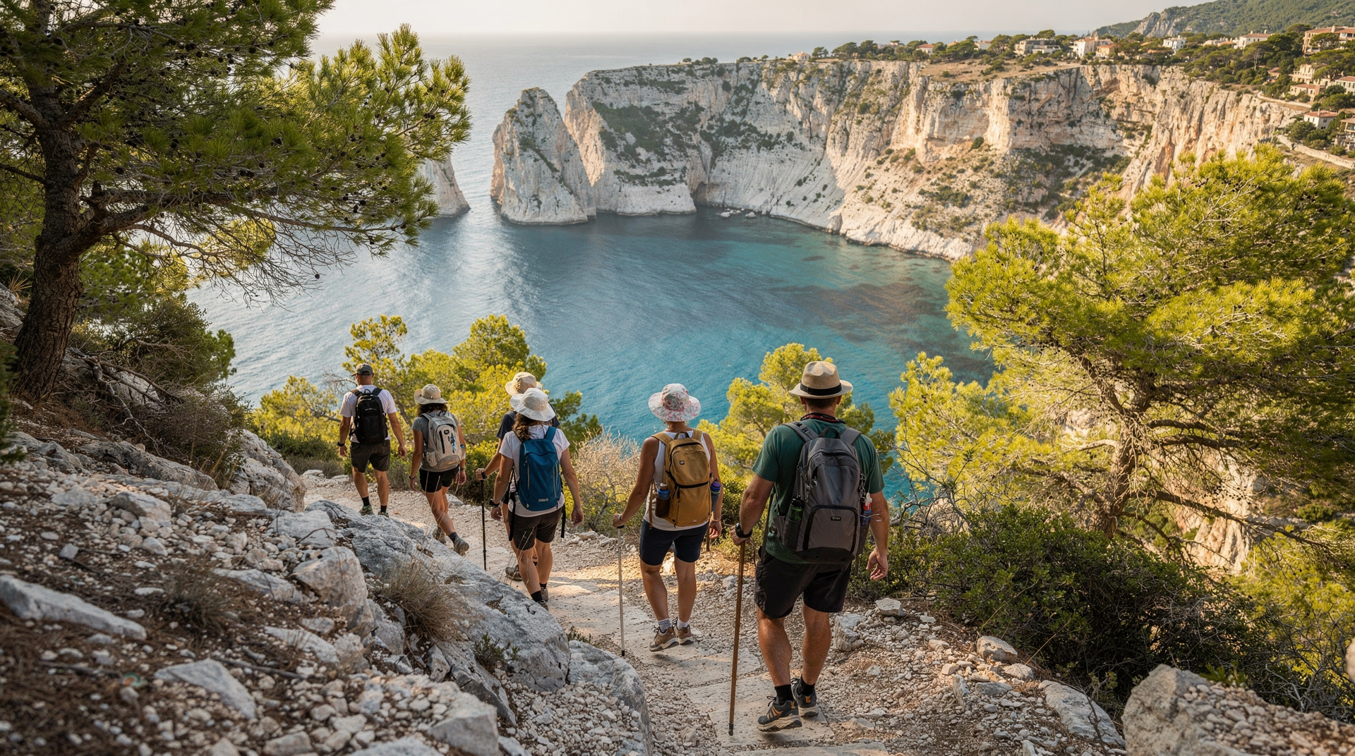
Hike option: The walk from Cassis village to the cap summit follows the Route des Crêtes road in part and diverges onto trail sections that offer closer views of the cliff edge. Total distance from Cassis port to the summit viewpoint: approximately 5–6 km one way, 400m+ elevation gain, 2–3 hours at a moderate pace. The walk back to Cassis is the same route in reverse, or you can descend toward La Ciotat and arrange a return transfer.
The honest comparison: The drive-the-corniche version delivers 80% of the Cap Canaille visual experience in 20% of the time and effort. The hike adds the physical experience, the closer cliff-edge views on the walking sections, and the satisfaction of earned height. The drive is the right choice for those combining Cap Canaille with a Calanques hike on the same day. The hike is right for those who want Cap Canaille as the primary experience.
Hiking from Cassis: the route
The most straightforward hiking approach from Cassis begins on the Route des Crêtes itself, heading east from the village. The first section of road climbing has no pavement and cars share the road — walk facing traffic, particularly on the lower sections where the bends are tight.
Cassis port to the Route des Crêtes start: 15–20 minutes on foot through the village, following signs for La Ciotat.
Route des Crêtes road climb to the first viewpoint: 1–1.5 hours. The road climbs steeply through dry garrigue — the ochre rock of the cap is distinct from the white limestone of the Calanques visible behind you to the west. The vegetation changes as you climb: lavender, rosemary, and broom give way to the more sparse vegetation of the higher exposed sections.
First major viewpoint (Belvédère de la Saoupe): At approximately 250 metres, a pull-off with broad views west across the Calanques. This is the first clear view of En-Vau and Port-Pin from height — the cliff geometry of the western calanques visible in profile from an elevation you cannot achieve from within the park itself.
Sémaphore viewpoint (summit area, approximately 380m): The main summit viewing area, also accessible by car. A former maritime signal station (sémaphore) sits near the cliff edge. The view from here is the full panorama: the Calanques massif west, the Mediterranean south, La Ciotat east, and Marseille’s urban mass north. On a clear day in winter or spring, the visibility can extend to the Îles d’Hyères more than 60 km east.
Summit to La Ciotat descent (optional extension): From the summit, the Route des Crêtes continues to La Ciotat, descending through the vine-covered southern slopes of the cap. This extension adds another 45–60 minutes and requires either a return taxi from La Ciotat or pre-arranged transport. La Ciotat has a train station (TER to Marseille or Toulon) making the one-way descent-to-train option practical.
The via ferrata on Cap Canaille
The via ferrata du Cap Canaille ascends the cliff face directly — a route of fixed iron rungs, cables, and steps embedded in the cliff face, allowing walkers without rock-climbing experience to ascend genuinely vertical terrain. The route gives a completely different relationship to the cliff than any walking approach.
Route: Multiple pitches climbing the main cliff face from the base to the summit, with some horizontal traverse sections. The total height gain is approximately 300 metres of via ferrata movement.
Difficulty: Classified as a medium to demanding via ferrata. The exposure is significant — you are moving across a near-vertical cliff above the sea for extended sections. A head for heights is essential; the route is not appropriate for those with vertigo. Physical fitness for sustained arm and leg work is needed.
Guided sessions: Certified guides lead half-day and full-day via ferrata sessions on Cap Canaille. All equipment (harness, helmet, via ferrata kit) is provided. No prior climbing experience is required, but reasonable fitness and no serious fear of heights are prerequisites. Sessions operate year-round subject to weather — check for wind conditions, as the cliff face is exposed.
What the experience delivers: The view from the cliff face during the ascent — looking down at the sea 200 metres below while moving across iron rungs — is one of the more visceral experiences available in the area. The arrival at the summit from below gives a different perspective than any walking approach.
Cap Canaille compared with the Calanques hiking
Cap Canaille sits just outside the Calanques National Park boundary (the park extends to the Cap Canaille headland but the cap itself is partly separate administratively). One practical difference: Cap Canaille hiking and the Route des Crêtes are not subject to the same fire-risk closure protocols as the Calanques interior trails. In July and August, when the Calanques trails are closed, Cap Canaille by car or on the Route des Crêtes may still be accessible. Check for any specific closure notices each year — drought conditions can lead to precautionary closures of any massif — but Cap Canaille is generally more accessible in summer than the Calanques trails.
This makes Cap Canaille a useful summer alternative for walkers who want some height and a view when the Calanques are closed. A morning drive or walk to Cap Canaille, with the afternoon on the Cassis port or beach, is a viable summer day.
Combining Cap Canaille with other activities
Cap Canaille + three-calanques hike: Too much for one day unless you are very fit. Choose one. In spring, do the calanques hike on one day and Cap Canaille on the next.
Cap Canaille + wine tasting: The Route des Crêtes descends through the AOC Cassis wine country on its way back to the village. Several domaines are visible from the road. A morning drive to Cap Canaille followed by a wine tasting at a Cassis domaine is an excellent half-day pairing. See the Cassis guide for wine tasting options.
Cap Canaille + La Ciotat: Taking the Route des Crêtes all the way down to La Ciotat gives two coastal towns in one day. La Ciotat has its own Calanques access (from the east, toward the Île Verte) and a quieter character than Cassis. The two towns combined make a strong Calanques coast day from Marseille.
Cap Canaille + Cassis sea kayaking: The view of Cap Canaille from a sea kayak in the bay is one of the most striking angles on this landscape — the orange-red cliff rising from the water with the calanques visible behind. A morning kayak session followed by an afternoon drive to Cap Canaille views the same cliff from both directions.
The geology of Cap Canaille: why it’s different from the Calanques
The Cap Canaille headland is composed of different rock than the white Cretaceous limestone that defines the Calanques. The ochre-orange-red colour of Cap Canaille comes from continental sandstones and conglomerates of Permian and Triassic age (approximately 250–290 million years old) — significantly older than the Calanques limestone and formed not in a marine environment but in desert and river conditions. The iron oxide content gives the distinctive colour.
The geological boundary between the red Cap Canaille material and the white Calanques limestone is visible from any boat in the bay between Cassis and Marseille — a sharp colour change at the headland that marks the boundary between two completely different geological periods. The contact zone between the two rock types occurs approximately at the Cassis village area.
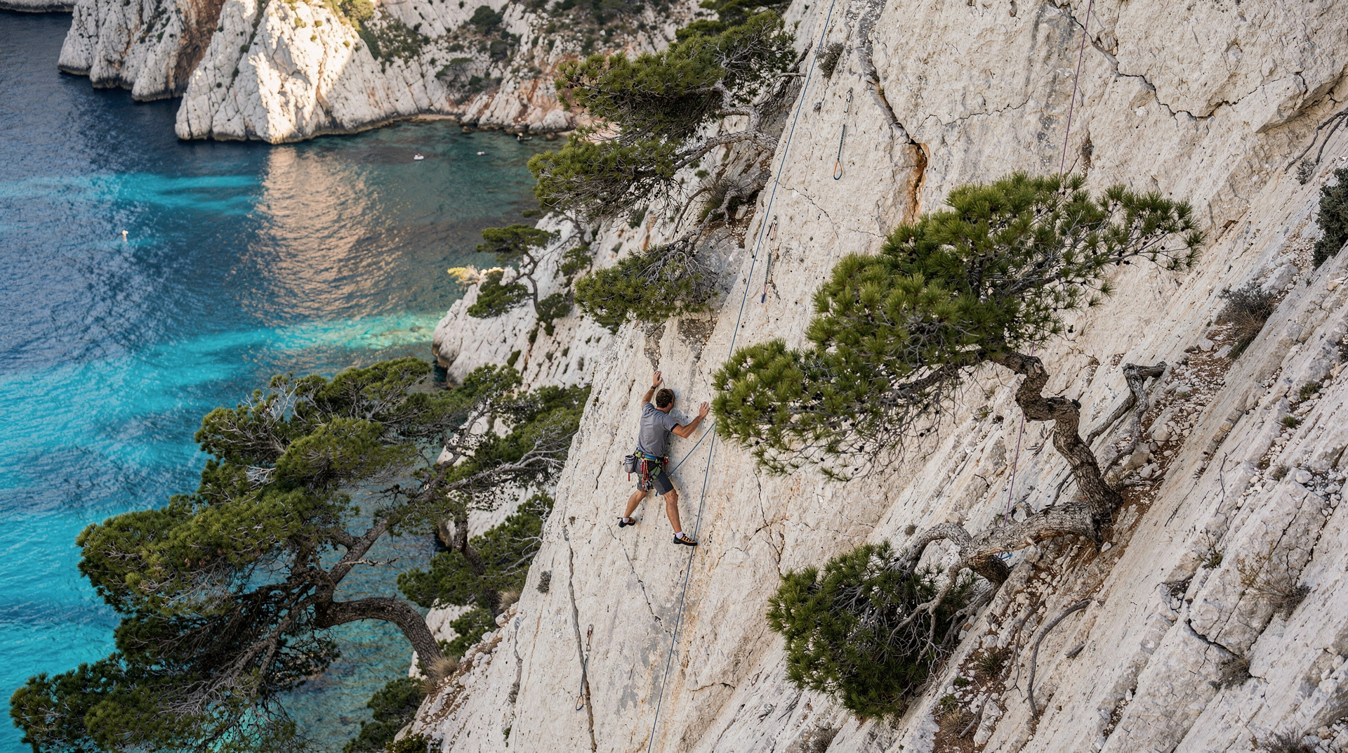
This difference in rock type affects more than colour. The Cap Canaille cliff is not a smooth wall like the white limestone faces of En-Vau — it erodes differently, creating a more irregular profile with ledges, gullies, and overhangs. The via ferrata uses these natural features for holds and rests.
The view from the top: what you can actually see
On a clear day from the Sémaphore viewpoint at the Cap Canaille summit (approximately 380–394 metres), the panorama extends:
West: The full Calanques National Park coastline from Cap Canaille to the Frioul Islands, with the white limestone cliff faces visible in profile. On a clear day, the Frioul Islands and Château d’If are clear approximately 20 km distant. The urban mass of Marseille is visible beyond.
East: The coast continues toward La Ciotat (8 km) and beyond toward Toulon and the Îles d’Hyères on very clear winter days (60+ km). The bay of La Ciotat and the La Ciotat marina are visible in detail.
North: The Provence interior — the Sainte-Baume massif (the prominent ridge visible approximately 25 km north), the Sainte-Victoire (Cézanne’s mountain, approximately 40 km north), and the urban development of the Marseille-Aix corridor.
South: Open Mediterranean, with the horizon at approximately 40–50 km in clear conditions.
The best visibility is in winter (December–February) after a mistral has cleared the atmosphere, and in the first morning hours before coastal haze builds. Summer visibility is typically adequate but the heat haze reduces the distance at which distant features are clear.
The practical guide to the Route des Crêtes drive
For visitors combining Cap Canaille with Cassis and choosing to drive rather than hike, the Route des Crêtes circuit makes a satisfying 45-minute loop:
From Cassis village: Take the D141A east toward the cap, climbing through the village outskirts and into the dry garrigue. The road narrows quickly and the coastal views open on the south side. Three main pull-offs with good views are marked; the Sémaphore viewpoint at the top is the summit car park (free, limited spaces).
Descent to La Ciotat: From the summit, the road descends the northern side of the headland to La Ciotat. The descent passes through vineyards (AOC Cassis wine country on the Cassis side grades into AOC Bandol territory on the La Ciotat side). La Ciotat at the bottom has a marina, the cinema museum (the Lumière brothers filmed some of their first footage here in 1895), and the access point for the Île Verte. See the La Ciotat guide.
Return to Cassis or continue east: From La Ciotat, either return to Cassis via the D559 coastal road (15 minutes) or continue east toward Bandol and Toulon.
For the Cassis base guide, see Cassis. For the Calanques hiking alternatives from Cassis, see the En-Vau hike guide. For the wider hiking safety context, see Calanques hiking safety. For those combining Cassis and La Ciotat, see the La Ciotat guide.
Without a car: getting to Cap Canaille from Cassis or Marseille
Cap Canaille has no public transport stop of its own — the Route des Crêtes is a driving and walking road, not a bus route. Visitors without a car have two realistic options: hike up from Cassis village (see the route breakdown above), or take a taxi from the Cassis port or station (around EUR 15-20 return with a short wait at the summit).
Coming from Marseille without a car, the practical plan is the TER train to Cassis (see the Marseille to Cassis transport guide for timetables and the Marcouline shuttle), then a taxi or the hike from the village. Combining Cap Canaille with a broader Cassis visit — the port, a Cassis wine tasting, or a stop at one of the Cassis beaches — makes the most of the trip out.
What to pack for the hike or via ferrata
For the walking route: sturdy shoes with grip (the road shoulder and trail sections are loose gravel in places), at least 1.5 litres of water per person, sun protection (the exposed garrigue climb has almost no shade), and a wind layer for the summit, which is often noticeably breezier than the village below. For the via ferrata, operators provide the technical kit, but closed shoes and a small water bottle that fits in a pack are still your responsibility.
Frequently asked questions about Cap Canaille hike
Is Cap Canaille the highest cliff in France? Yes — at 394 metres it is the highest maritime cliff in mainland France, taller than any cliff in Étretat or along the Atlantic coast.
Can you swim at the base of Cap Canaille? Not directly below the cliff itself — there’s no easy shore access at the cliff base. The nearest swimming is back in Cassis at the Cassis beaches or in the calanques to the west.
Top experiences
Bookable activities with verified prices and instant confirmation on GetYourGuide.